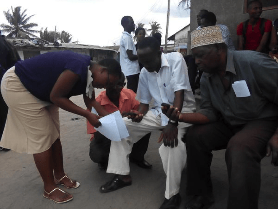
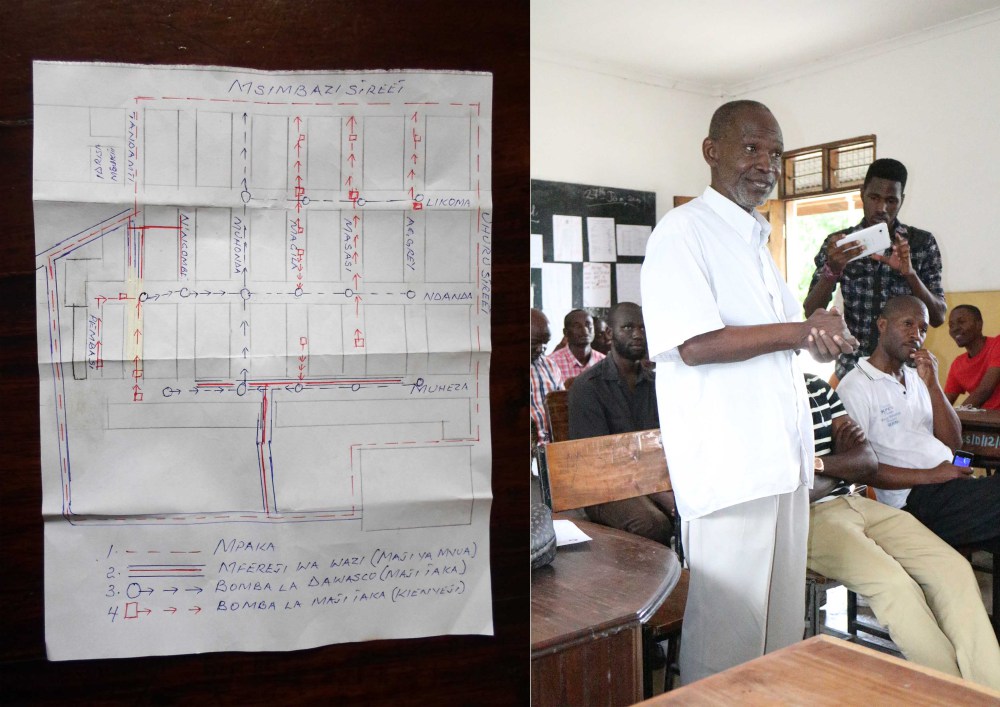
@AndrewGwantwa explains how GPS works to community members at the Mabibo Community Forum PHOTO CREDIT: Ramani Huria
As part of our continuing work to map Dar es Salaam, Ramani Huria began mapping an additional six wards of the city: Makumbusho; Makurumla; Mabibo; Mburahati; Msasani; and Keko
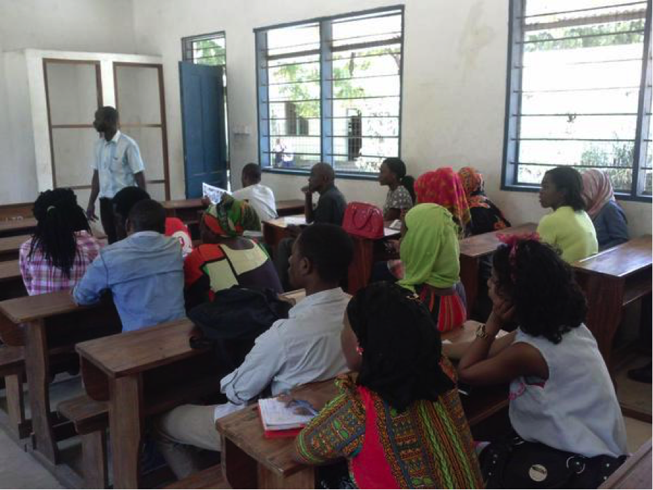
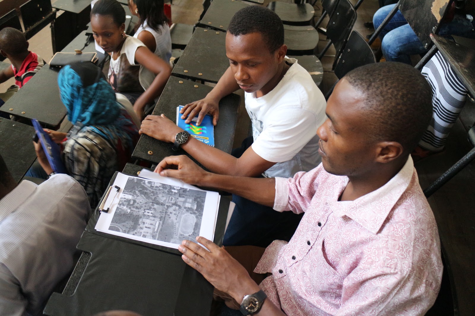
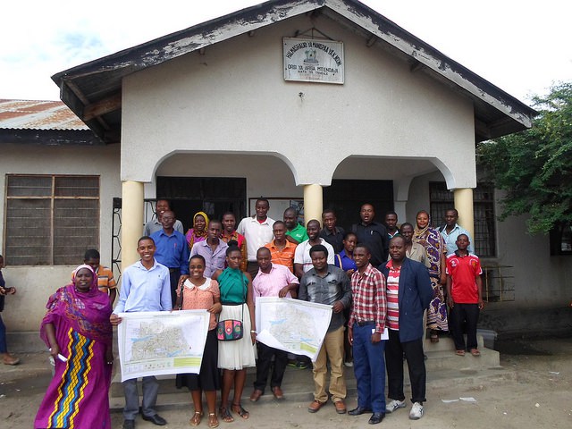
A community forum in Msasani Ward PHOTO CREDIT: Ramani Huria
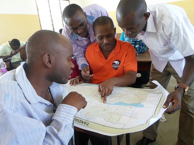
The mapping was launched with community forums in each of the wards on July 13-14th. The forums drew together community members from the respective wards and students who have been assigned to work with the community and map the wards.
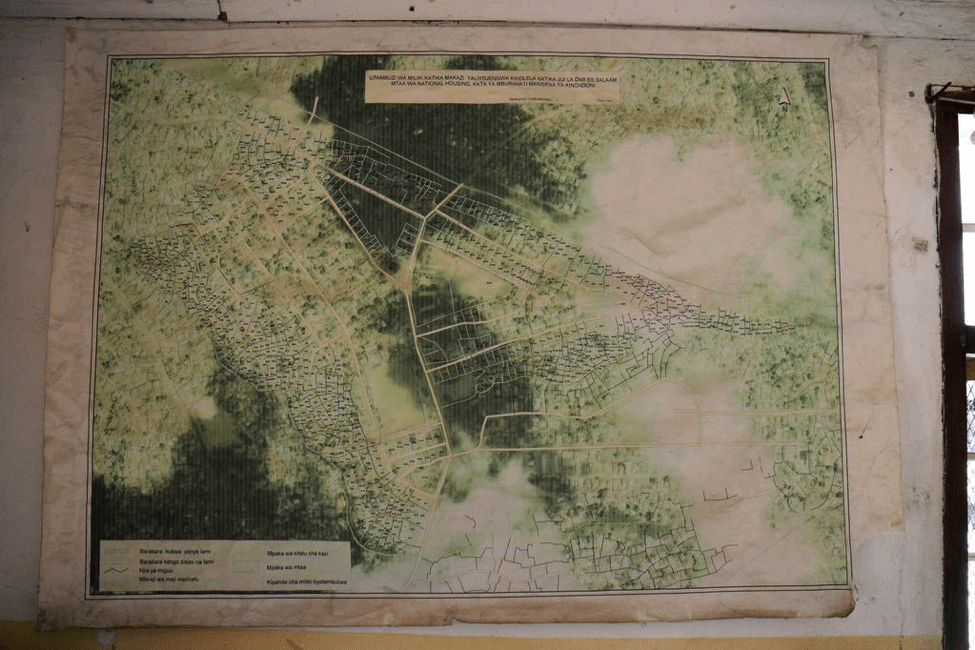
Current map of Mburahati at the ward office. Ramani Huria will produced detailed and updated maps of all six additional wards. PHOTO CREDIT: Ramani Huria
The students involved in mapping the wards come from the University of Dar es Salaam and Ardhi University and have received holistic training in mapping techniques, including the use of field papers, GPS, and OpenStreetMap.
Ramani ya sasa ya mburahati katika ofisi ya kata.ramanihuria iliendelea kutengeneza ramani zenye taarifa za kina na za sasa kwa kata sita za ziada.Picha na:Ramani Huria
Wanafuzi walioshiriki katika utengenezaji wa ramani walitoka katika vyuo vikuu Ardhi na Dar es salaam na walipokea mafunzo ya mbinu utengenezaji ikiwemomatumiziya GPS,makaratsi ya maeneo pamoja na (open streetmap)
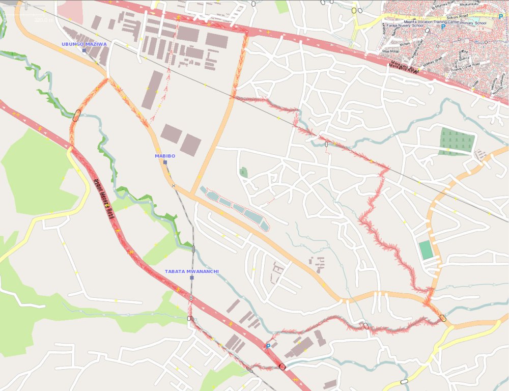
Mabibo ward before mapping IMAGE SOURCE OpenStreetMap
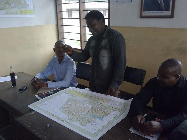
The mapping of the wards is expected to take around two weeks and once completed, the data and maps will be presented to the community members in closing forums.
Daud Fufuji (World Bank) presents community mapping to President of the United Republic of Tanzania, Jakaya Kikwete PHOTO CREDIT: World Bank
The Fourth Tanzanian Annual National Science, Technology and Innovation Conference took place recently in Dar es Salaam from 17th-19th of June. The conference presented the opportunity to showcase Ramani Huria and community mapping in Dar es Salaam to the President of the United Republic of Tanzania, Jakaya Kikwete.
Daud Fufuji, Open Data Consultant with the World Bank’s Tanzania Office, presented mapping activities to the President, as well as key officials from the Tanzania Commission for Science and Technology (COSTECH) and Human Development Innovation Fund (HDIF). The presentation included detailed maps of the recently completed of Tandale and Ndugumbi wards. In addition to presenting the work achieved by community mapping, Daud Fufuji also explained the opportunities and achievements made by the use of drones in mapping the city.
Daud Fufuji explained that the Ramani Huria community mapping program involves both citizens and university students, working together to create digital maps by using simple and accessible technology, including GPS, field papers, and OpenStreetMap (OSM). All data is then uploaded and can be accessed by any individual with an internet connection. Local citizens possess an understanding of their communities and traditional knowledge, allowing them to highlight where problems arise. With the assistance of students, who contribute their academic knowledge, the maps created can allow citizens to present to stakeholders and services providers, giving them relevant data to take action when needed, for example, becoming more resilient to flooding. The potential of drones to support community mapping was also highlighted, with Daud Fufuji explaining to the President that drones can help greatly in aerial photography. The drones take aerial imagery with a high resolution allowing for the identification and digitization of infrastructure i.e roads, buildings, drainage, rivers and other related spatial features. In addition, once acquired, drones are low cost and safe, they don’t require a pilot and are simple to launch and land. As they run off rechargeable batteries, fuel costs are also reduced.
President Kikwete asked what problems could be seen in the maps presented and it was explained that the maps showed flood-prone areas within the wards. These areas are detrimentally affected by flooding due to poor infrastructure, including issues with drainage, solid waste management, and limited access to houses. Additionally, it was highlighted that this poor infrastructure means children can’t go to school when flooding occurs (due to lack of pathways) and diseases may spread (due to poor waste management).
The President was extremely impressed by the maps created, calling them beautiful, and was positive about the potential of the continued mapping of Dar es Salaam under the Ramani Huria project.
Following the community mapping for flood resilience scale up workshop that took place on Monday 6th July, 2015 many students in attendance were inspired and motivated to join the Ramani Huria project, using maps to help reduce the effects of yearly seasonal floods. Ramani Huria signed up one hundred fifty students for training in mapping, including final year students from University of Dar es Salaam and internship students from Ardhi University.
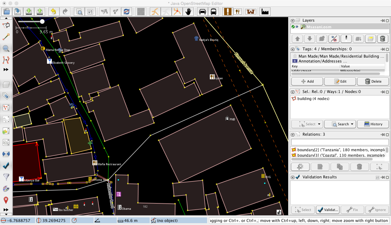
Example of JOSM in use. PHOTO CREDIT: Ramani Huria
The students who signed up following the workshop participated in three days of training hosted at the University of Dar es Salaam. The training was conducted by fifteen student supervisors from Ardhi University, who prior to leading the training received three months of instruction with Ramani Huria. The three days of training for new students included an introduction to OpenStreetMap (a free editable map of the world) and mapping tools such as field papers (including their use and how one can create his/her own) and the GPS Unit (eTrex 30), used to record tracks and waypoints. In addition to the learning curriculum, the training included use of the OSM Tracker (an open-source Android phone application available in the Google Play Store) which does the same work as the GPS Unit for data collection but has a more user-friendly interface. Lastly, training was given in JOSM software, an open-source offline editing tool of OpenStreetMap. A variety of editing techniques and skills were taught to the students during the training.
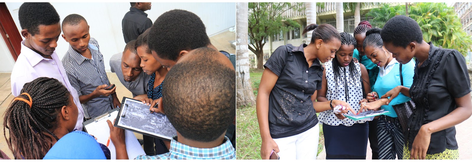
Training Students on Field Data Collection. PHOTO CREDIT: Ramani Huria
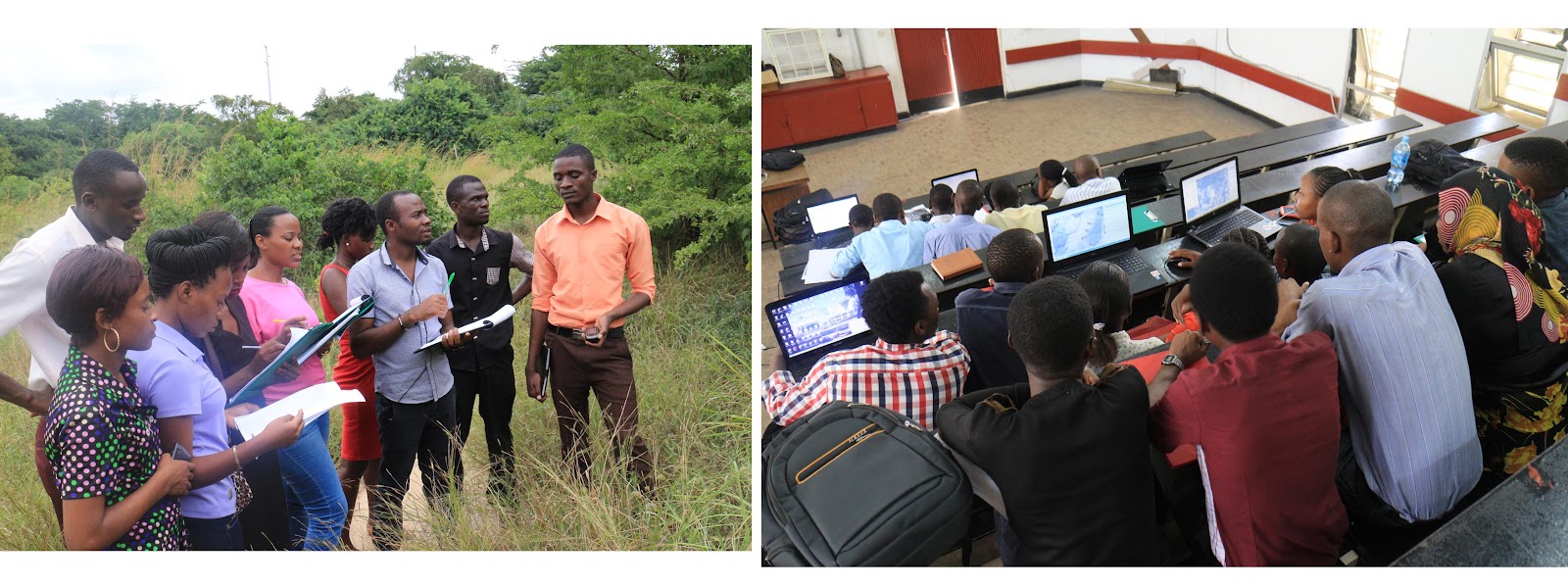
The first two days of training were theory based on the third and final day being fully practical and hands-on. Students applied their newly gained knowledge to map with areas across the University of Dar es Salaam campus.
Following the training session, Ramani Huria successfully activated one hundred fifty new active OpenStreetMap users from the two universities. These students will be part of the community mapping of six wards across Dar es Salaam. These six wards were selected from seventeen flood-prone wards and include Mabibo, Mburahati, Makurumla, Makumbusho Msasani and Keko.
At a later stage, the data collected and edited in OpenStreetMap will be used in InaSAFE (an open-source software used in QGIS) to help model disaster scenarios and will provide information to assist in allowing for better planning and response to floods by government authorities/offices.
PHOTO CREDIT: Ramani Huria
Through participating in this training the students have receiving skills not taught within their school curriculum, giving them an advantage in future employment. In addition, Ramani Huria aims to have active mappers even after the project has accomplished its goals. One way this is already being put into practice is through monthly mapping parties. These are open to all members of the community, in addition to students, and we invite enthusiastic and new mappers to help edit areas that need maps with the use of the HOT Tasking Manager. Stay tuned for updates on the next mapping party and additional ways of how you too can be involved in community mapping!
The ward of Tandale was one of the first wards in Dar es Salaam to benefit from community mapping and be comprehensively mapped on OpenStreetMap. Ramani Huria recently spoke to Ward Executive Officer for Tandale Mr Osiligi Lossai about how they are using the data and maps provided to the ward following the completion of mapping.
Map of Tandale created through community mapping: download here CREDIT: Ramani Huria
Dar es Salaam experienced a rare cholera outbreak in August 2015, and it is continuing to affect the city. Tandale has been one of the wards most affected by the outbreak. The outbreak has been unexpected as it is currently the dry season in Tanzania, with incidences of cholera usually occurring during the rainy seasons. Mr Lossai said that his office has been using the maps provided by Ramani Huria to identify the location of the victims within the ward. The maps have provided them with detail information on water points and sanitation data, thus allowing his team to investigate the sources of the outbreak.
Drainage map of Tandale created through community mapping: download here CREDIT: Ramani Huria
Mr. Lossai is in the process of writing a project proposal to the Municipal Council which aims to improve the drainage system in his ward. While he acknowledges that people have settled in flood-prone areas, he says it is not easy or likely to resettle them. Because of this, the current situation must be improved, and this includes developing the drainage system. With the maps developed by Ramani Huria, which include current drainage infrastructure, Mr Lossai is better informed and able to identify key points to be developed or improved in future planning.
Following on from the mapping that took place in Tandale, Mr. Lossai has developed relationships with Urban Planning graduates who continue to help him and his colleagues in the future planning of the ward and improving the livelihoods of those who live there. Mr. Lossia concluded by saying that the maps created through community mapping have been invaluable and will continue to be of use to the ward of Tandale in years to come.
Attendees at the Scale-Up Workshop gather outside Nkrumah Hall. PHOTO CREDIT: Humanitarian OpenStreetMap Team
The Dar Ramani Huria Scale Up Workshop took place at Nkrumah Hall, University of Dar es Salaam, on Monday 6th of July. Over the next three months, the Ramani Huria project ‘Community Mapping for Flood Resilience’ will be building on previous work and expanding mapping of additional wards across Dar es Salaam.
The scale-up will be lead by a group of fifteen students who have been trained by the Humanitarian OpenStreetMap Team (HOT) and previously worked with community members to map Ndugumbi, Tandale, and Mchikichini wards. HOT staff on the project are Paul Uithol (project manager), Geoffrey Kateregga (lead mapping supervisor), Steven Bukulu (mapping supervisor), and Sophie Lafayette (media specialist). In the coming weeks, the project with involving an additional 140 university students from the University of Dar es Salaam (UDSM) and Ardhi University, as well as community members from across the 10 to 14 wards to be mapped.
In the first phase of the scale-up, six wards will be mapped, including Makumbusho, Makurumla, Msasani, Mburahati and Mabibo. The wards to be mapped during the project are some of the most densely populated areas of Dar es Salaam and consist mostly of informal settlements. Settlements in these wards are also often built in flood-prone areas, leading them to be heavily affected when flooding occurs.
SOURCE: Ramani Huria (2015)
The Scale-Up Workshop consisted of two panels and a student participation workshop, with both students and ward officials in attendance. Guest of Honour at the event was Julia Letara, Municipal Town Planner for Kinondoni Municipal Council.
Guest of Honour, Julia Letara PHOTO CREDIT: Humanitarian OpenStreetMap Team
The event was opened by Dr Philip Mwanukuzi, Head of the Department of Geography (UDSM), a representative of the Principal of College of Arts and Social Sciences (UDSM), and the Guest of Honor, Mrs Julia Letara.
The first panel (L-R): M.Iliffe, J.Letara, Dr P. Mwanukuzi, H.Hambati, G.Kateregga PHOTO CREDIT: Humanitarian OpenStreetMap Team
The first panel, ‘Engaging in Flood Mapping’, began with a primer entitled ‘Our State of the Map’ by Geoffrey Kateregga, the Mapping Coordinator for HOT. The panellists included: Julia Letara (Municipal Town Planner, Kinondoni Municipal Council); Mark Iliffe (Geospatial Specialist, World Bank); Dr Philip Mwanukuzi (Head of Department of Geography, UDSM); Professor Herbert Hambati (Professor of Geography, UDSM); and Geoffrey Kateregga (Lead Mapping Coordinator, HOT). This panel gave an overview of the progress achieved by the ‘Community Mapping for Flood Resilience’ project and an introduction to mapping tools used in the project. Julia Letara, highlighted that new technologies offer exciting opportunities, including giving citizens a voice and helping inform public service delivery.
The second panel (L-R): V. Deparday, D.Minja, K.Hamis PHOTO CREDIT: Humanitarian OpenStreetMap Team
The second panel, ‘Connecting Communities’, began with a primer entitled ‘Global Experiences of Community Mapping’ by Vivien Deparday from the Global Facility for Disaster Reduction and Recovery (GFDRR). The panellists included: Deogratias Minja (Open Data Consultant, World Bank); Vivien Deparday (Disaster Risk Specialist, World Bank); and Kamal Hamis (Ndugumbi Ward Community Member). The panel, and following question and answer session, put community mapping in the context of Dar es Salaam, specifically the way in which the data collected through mapping could be used for planning and disaster reduction.
Following the two panels, there was a lunch break, after which students returned for a workshop on ‘The Process of Mapping’, led by the team from HOT.
Students in the practical workshop PHOTO CREDIT: Humanitarian OpenStreetMap Team
The first part of the workshop began with an introduction to mapping techniques. To further boost the project activities, HOT has acquired two drones for the project from senseFLY, which will help provide high-resolution aerial imagery that will make mapping easier and more accurate. Included in the workshop introduction was a short demonstration and overview of the drones. The second part of the workshop allowed the students to experiment with mapping techniques and put their initial training into practice.
Following the Scale-Up Workshop, students were given complete training in mapping tools and techniques (July 7-9th), before the commencement of mapping (July 13th). The course materials used are available on the project’s Github repository, at https://github.com/hotosm/RamaniHuria.
Mchikichini ward community member Mr Monday Antony CREDIT: Ramani Huria
Mr. Monday Antony is a 66-year-old Tanzanian, living in Mchikichini ward, Ilala District, Dar es Salaam. He participated in “Community Mapping for Flood Resilience”, and talked to Steven Bukulu (mapping supervisor for Ramani Huria) about the flooding in many areas of Dar es Salaam.
“The population has decreased in the low altitude areas since the last tragic incident of floods that happened in 2013, which got all houses submerged in water. Due to the loss and damage of property, many of these people shifted to safer areas to improve and build up their lives. In addition, many of their small scale businesses were no more.”, he says. “Many of those that are currently living here are new to this area. They have no clear clue or idea of what floods can do to them when heavy rains occur,” he adds. “What has greatly contributed to floods in Dar es Salaam is the way that houses have blocked passage for large volumes of water. This water collects from different areas on higher altitudes of the city to big waterways and channels like River Msimbazi that passes through this ward.”
Flooding in Dar es Salaam CREDIT: Ramani Huria
On top of that, residents of these areas have poor waste disposal behavior. “People don’t care where they are supposed dump their garbage which takes us back to poor urban planning. If only they knew how this has greatly contributed to drains being blocked 24/7 till now as we speak in a dry season, then they would understand what proper way they should do it. These drains help so much in reducing floods by draining large volumes of water from different areas to the main water channels and help reduce the floods. Without this happening, we can’t avoid floods”, he stresses.
Mr Monday Antony, who himself was not affected by the last floods that happened earlier this year in May 2015, says that people’s lack of response to bad weather forecasts has caused them damages that include loss of property and serious injury. “If only they would be attentive on what is said on the news, all this disaster wouldn’t happen.
Considering community involvement in mapping for flood resilience in Mchikichini Ward, Mr Antony confesses that the activities were really important to them and the outcome will be even better since the data would have been verified by the local community. He sees it as being an important program for local people to participate, even though the biggest challenge is that it is very hard for those who didn’t draw maps during their early stages of education to adapt to the current digital mapping skills with the use of computers, GPS units and Field Papers.
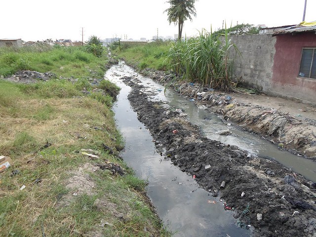
Drainage ditches in Dar es Salaam CREDIT: Ramani Huria
Mr Antony agrees with the view that digital mapping is essential for keeping current records for the future generation. In addition to that, digital maps can be shared and accessed at any one time on the internet through OpenStreetMap. He suggested that subward officers should be informed that this data is open source so even in their absence, the same information can be retrieved and used for administrative work. He also points out the essential nature of maps during National census, vaccination campaigns and urban planning. As well as when setting up polling stations ahead of elections, and improving social services like health centres, schools, roads, water supply, and electricity distribution. This will build stronger communities to promote equity and opportunities.
Mapping in process in Dar es Salaam CREDIT: Ramani Huria
Mr Anthony ascertains that once the learning material is put into hard copies, it will be easier for the community to pass on the skills of digitizing different areas on OpenStreetMap to other people who are not yet exposed to this technology, including his generation. “It has now been translated in Swahili, that makes it much easier,” he says.
Mapping in process in Dar es Salaam CREDIT: Ramani Huria
Finally, he tells us: “Mapping begins with one’s interest. If all the people that are interested in mapping receive advanced training, they would be able to make a huge difference to the socio-economic development in Tanzania, and assist in training other people in their community once the project is done.”
Mapping activities in Tandale were wrapped up at the Community Forum at the ward office on May 29th, 2015. In Tandale, five weeks of mapping work have been performed by community members of this ward and Ardhi University students, from April 21st 2015 until May 22nd.
The Community forum officially delivered the maps of Tandale. Ward officials were presented with maps of the roads, buildings and drainage network.
Two media outlets were present to cover the event, The Guardian News Paper and the television station Channel Ten. Opening remarks were made by one of the ward officials, Mr Kalema, at 10:30, who welcomed the audience and thanked all the participants for volunteering towards having Tandale mapped up to date.
After Mr Kalema, the ward officer Mr Osiligi spoke: “Administrative work has been made clearer and easier for the Tandale ward office; now we can make better proposals with clear evidence with the use of these maps”. He added that these maps will not only help the ward office but all the people of Tandale. And even far beyond, since the information is open source and can be accessed freely through the www.openstreetmap.org website.
Different technological ideas, methods can be developed by the people of Tandale due to this data to help with flood resilience. Wetlands are clearly shown so people can avoid or evacuate these areas due to the dangers that may come about during heavy rains. Additionally, road networks have been made clear thus making easier navigation in Tandale. “We can benchmark on this information to make Tandale a better place than it is right now.”
Discussing what comes after mapping in Tandale CREDIT: Ramani Huria
“Now we have the maps, what comes next?”. This important question was raised by Mr Daniel, a sub-editor from The Guardian Newspaper. Deogratius Minja, representing the World Bank, gladly answered the question during his speech: “Towards the end of the project with all this data available online, maps clearly indicating realistic natural hazard areas and impact scenarios will be produced. This will allow for better planning, preparedness, and response activities using InaSAFE software which is free to download and is open source. The community will come to appreciate the importance of our activities by seeing all these maps”.
Deogratius Minja, representing the World Bank discusses what comes after mapping CREDIT: Ramani Huria
Geoffrey Kateregga from the Humanitarian OpenStreetMap Team told the audience that Ramani Huria is increasing capacity for open data collection by training University students and community members in mapping skills which are being put into effective use for risk analysis.
Innocent Maholi, a student from Ardhi University also got to describe the mapping process, he said, “With a combination of GPS Units, Field papers and JOSM software we were able to update Tandale onto the free editable map of the World, OpenStreetMap. We were provided with clear drone images which are up to date plus easy to collect data with”.
Mr Salim Mtepetallah, who represented the community members, promised to continue with the mapping since now they have the skills, plus encouraging more people to join the mapping community by training them how to map.
Community members discuss mapping and Tandale ward CREDIT: Ramani Huria
An open discussion followed which had the audience give their views about the project and how it will help with flood resilience. Mr Nassoro Mzee, a community member, explained that the unplanned settlement in Tandale has greatly contributed to floods in Tandale during rainy seasons. People have constructed their houses over water drains, ditches, and in wetlands. To make it even worse, there is poor waste disposal from their residences; most just dump it outside, where it ends up blocking the few available drains that would have helped drain the water to larger water channels. With the availability of these maps, including those that clearly show the drainage network in Tandale, more effective settlement planning can be done in the future to make Tandale better than it is today
The Ramani Huria team officially handed over the maps to the Executive ward officer accompanied by two sub-ward officers. All community members that participated in the mapping activities were awarded Certificates of Participation for their efforts to make this a success.
Community members receive printed maps of Tandale ward CREDIT: Ramani Huria
Closing remarks were given by Steven Bukulu, who acknowledged the presence of the media houses that will broadcast this to the entire nation. The Guardian News Paper will publish an article on Monday 1st June 2015 while Channel Ten will show it in the 7:00 pm evening news, Saturday 30th May 2015. A group photo was taken outside the ward office to wrap up the event.
Community members and Ramani Huria at the Tandale ward office CREDIT: Ramani Huria
Next week, we will start off in Mchikichini, the next ward to be mapped and updated on OpenStreetMap!
Ramani Huria began mapping Tabata ward on 7th October and completed mapping on 6th November 2015. Tabata is an administrative ward in Ilala district in western Dar Es Salaam and according to the 2012 census has a population of 46,228.
Tabata ward before mapping began SOURCE: OpenStreetMap
apping was launched in the ward with an opening community forum, taking place at the ward office, and attendance included: Tabata Ward Executive Officer (WEO); eight Mtaa Executive Officers (MEOs), five Mtaa chairmen; eight community members; and representatives from the Ramani Huria team.
An opening community forum in Tabata PHOTO CREDIT: Ramani Huria
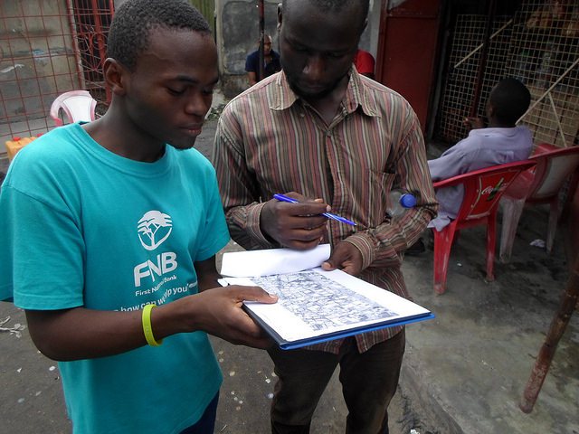
Active mapping started on 12th October with data collection and relevant information for the mapping process was collected from the field using GPS units and attribute tables. Data collected including information relating to buildings, roads, waterways, and points of interest, and this was digitalized using JOSM software.
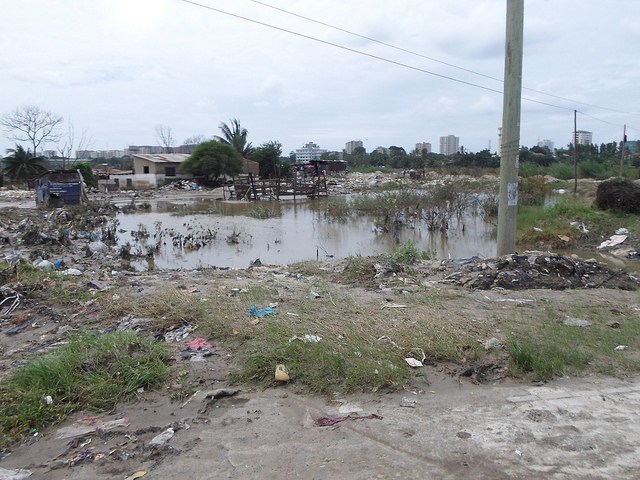
In the process of mapping, the mappers observed a number of issues relating to the effects of flooding. One of the goals of Ramani Huria is that data we collect can be used to improve flood resilience at a local level.
Observing Flooding in Tabata
The city of Dar es Salaam is affected by seasonal flooding, with some wards being more severely hit and for a variety of reasons. Our mappers include community members who are able to provide first-hand information about the features of the ward, and how each ward is specifically affected by flooding.
In Tabata, housing construction has a severe impact on the scale of flooding. In sub-wards Tabata Muslim and Tabata Aroma, there are buildings constructed across a stream that collects water from the road’s drains. Due to this, only a small amount of water can flow, and in the rainy season the large volumes of water cannot flow sufficiently. As a result, flooding occurs, specifically affecting the residential buildings.
Small scale sand mining activities take place in the Msimbazi River valley, bordering the east and southern parts of the ward, and have resulted in the widening of the river valley. As a result of this, the effects of flooding has increased, specifically affecting residents and properties in Magharibi sub-ward.
Build-up of waste in waterways and construction over drainage in Tabata PHOTO CREDIT: Ramani Huria
We observed the buildup of waste in the streams, drains, and ditches of the ward. Poor organisation of waste disposal and maintenance of drains are therefore additional factors that increase the severity of floods. As waste builds up in the streams, drains, and ditches, the flow of water is restricted and cannot flow out of the ward and causes flooding during the rainy season.
The effect of flooding in Tabata
Build up of soil deposits around housing as a result of flooding PHOTO CREDIT: Ramani Huria
Due to annual flooding, soil deposits build up around buildings, resulting in the appearance of their height being reduced. The buildup of deposits also increases the ease of water to enter the building and so causing them to be more severely affected each year.
During flooding, many residents and businesses move property out from within buildings, in the hope of avoiding further water damage if the building is already flooded or at risk of flooding. This is extremely inconvenient and can be costly, both due to transportation and interruption to work and daily life. The sub-wards of Msimbazi Magharibi, Msimbazi Mashariki, Tenge and Matumbi, are especially affected in this way.
In severe cases, properties may be completely destroyed as a result of flooding. We observed this occurring in Msimbazi Magharibi and Mashariki sub-wards, along the Msimbazi River valley. Due to flooding buildings may be abandoned, as they also become dangerous to occupy, and over time may become even more worn down, resulting in demolition being the only option.
Actions taking place to reduce the effects of flooding in Tabata
Changes are being made in construction, with many buildings now being raised with the aim of reducing the effects of flooding. Residential buildings, kitchens, and toilets are also being elevated to raise them above flood lines of previous years.
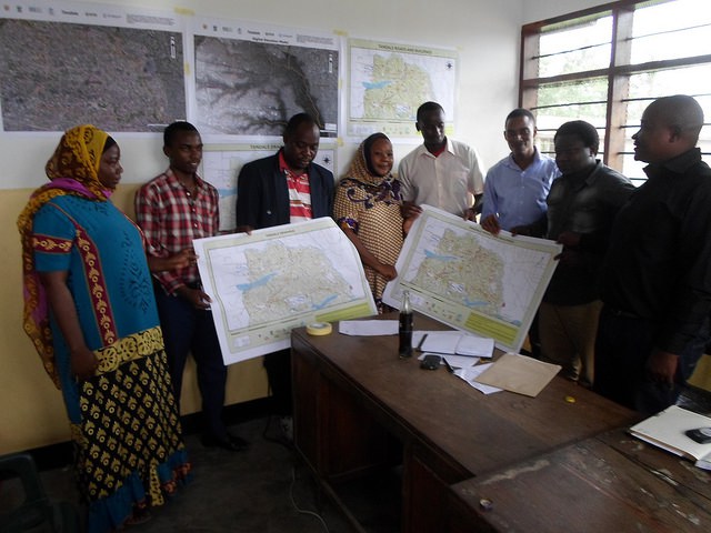
Presenting maps to Tabata community
Maps presented in Tabata ward PHOTO CREDIT: Ramani Huria
Closing community forums were held in Tabata ward on 27th of November, with maps being presented to the Ward Officer and ward community. The experiences of mapping were discussed among those in attendance, specifically how these resources can help improve flood resilience within the ward. Additionally, certificates were presented to students and community members who assisted in the mapping process.