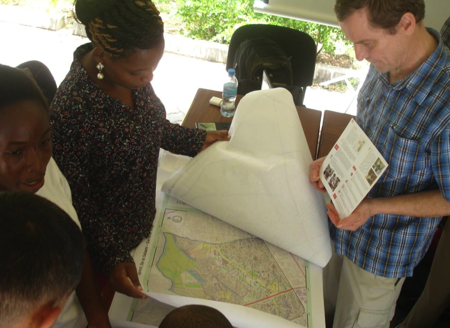
GIS Day was held at the University of Dar es Salaam on Thursday 10th of December, with exhibitions taking place on campus at Nkrumah Hall. The day was an opportunity for Ramani Huria to showcase our ongoing work of community mapping for flood resilience.
Explaining Ramani Huria’s work to attendees at GIS Day PHOTO CREDIT: Ramani Huria
The day was attended by a range of academics including Dr Mwanukuzi, Head of Geography, University of Dar es salaam; Professor Ylisto, Head of Geography and Geology, Turku University-Finland; Dr Niina, HEI-GIS (Higher Education Institution) Project Coordinator from Finland; and a number of lecturers and students from the Geography Department at UDSM and the wider university community.
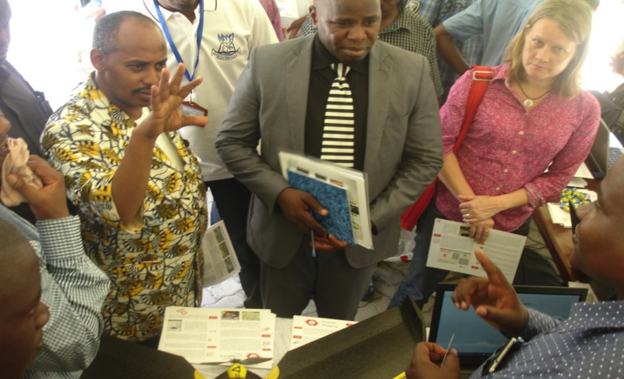
Explaining our mapping process and the use of drones PHOTO CREDIT: Ramani Huria
Ramani Huria gave demonstrations on our work, tools used by the project, such as GPS units, software used, such as JOSM and QGIS, and the use of capturing aerial imagery with the use of drones. The use of drones drew attention and attendees were impressed with the high resolution of images collected, included that speed at which imagery can be collected if urgently needed.
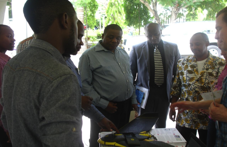
Discussing the mapping process with attendees PHOTO CREDIT: Ramani Huria
Many of those in attendance were interested in the open-source element of Ramani Huria’s work. The data we collect is all freely available and we use open-source software whenever possible in our work. This approach allows anyone to freely access our data and further develop it.
While our initial motivation for Ramani Huria is to apply the data collected for flood resilience, there are many situations in which the data could be used according to the needs of the user. City planners and students were very interested in how the data collected could be used for academic purposes such as research and dissertations.
Ramani Huria was grateful to the University of Dar es Salaam for including us in GIS Day and we look forward to participating in many more events on campus in the future.
The Ramani Huria team was proud to be part of the first Africa Open Data Conference, taking place in Dar es Salaam Tanzania. The event drew speakers and attendees from all over the world, to discuss, debate and showcase ‘local and global examples of open data being produced, published, visualized, and captured in creative ways across Africa.’
The conference took place over two days (4th to 5th of September) at the Julius Nyerere Convention Center, with pre-conference events taking place on the 2nd and 3rd of September at the National Museum and House of Culture.
President Jakaya Kikwete opens the conference CREDIT: Ramani Huria
The conference was officially opened by the President of the United Republic of Tanzania, Jakaya Kikwete, who in his opening remarks stated that the event signified the dawn of a new era in Africa’s transformation towards knowledge-based development. The President highlighted that open data can assist institutions, organizations, and individuals in diagnosing social and economic challenges of Nations and societies, and can inform both policy and decision-makers. Additionally, open data can be useful in monitoring and evaluating progress and impact. In his concluding statements, he noted that open data is vital to both governments and the citizens who benefit from the services provided by various institutions.
President Kikwete tours the Africa Open Data Conference expo and is shown the mapping bajaj CREDIT: Ramani Huria
In addition to opening the conference, President Kikwete toured the expo outside the main conference hall, showcasing key projects utilizing open data. Ramani Huria was proud to display our work to the President, specifically how through using local communities & students we are able to create sophisticated and accurate maps of flood areas in Dar es Salaam.
The biggest crowd-pleaser in the expo was the ‘mapping bajaj’! With support from Trimble & Mapillary, Ramani Huria has adapted a bajaj to hold two cameras, including the Trimble MX7. The mapping bajaj is currently taking street view imagery with these cameras, which will be uploaded to Mapillary – an online map and community of crowdsourced, free and openly licenced street-level photos. Anyone can view the current (and continually updated) street views of Dar on the Mapillary website here. With the Mapillary App you can also help add to the crowdsourced map and add street views.
Africa Open Data Conference in session CREDIT: Ramani Huria
The conference itself consisted of a number of presentations and panels through the two days, with speakers from Tanzania and across the world, all with a focus on open data in Africa. The first panel, led by Maria Sarungi-Tsehai, looked at first understanding and defining open data.
The key idea behind open data being that certain types of data should be freely available to everyone to use and republish as they wish, without restrictions from copyright, patents or other mechanisms of control. It was highlighted that the use of open data has grown within the last few years, especially in use in economic development. A number of examples of open data in Africa were spoken about, including the work being done by the Ramani Huria project.
Geoffrey Kateregga presenting how Ramani Huria is promoting open data through our mapping activities across the city of Dar es Salaam CREDIT: Ramani Huria
Geoffrey Kateregga, the Lead Mapping Supervisor in Ramani Huria, presented the project and how we are promoting open data through our mapping activities across the city of Dar es Salaam, “Of all the cities in Africa, Dar es Salaam is proud to have one of the most detailed maps on OpenStreetMap. With contributions from local community members and university students, these maps are free to anyone to access online.” He highlighted how drones have been used for the first time in Africa to produce high-resolution aerial imagery for mapping flood-prone wards in Dar es Salaam. This has ensured accurate and up-to-date data is being used to create sophisticated maps, which are in turn shared on OpenStreetMap.
Mapping supervisors from the Ramani Huria project & HumanitarianOpenStreetMap at the conference CREDIT: @TylerSRadford
On the second day of the conference, Tyler Radford, Humanitarian OpenStreetMap Team (HOT) Interim Executive Director, presented HOT’s activities in Dar es Salaam and the work being done through the Ramani Huria project. With an experience of mapping vulnerable and unmapped locations across the world, HOT is overseeing community mapping efforts in Dar es Salaam in order to map the most flood-prone wards of the city. He put the work in the context of open data, explaining that maps are created in collaboration between students and community members, produced and presented to the communities in each ward, and all finally data is freely accessible online to anyone.
For further information about the Africa Open Data Conference, speakers in attendance and all the presentations, see http://www.africaopendata.net/.
Daud Fufuji (World Bank) presents community mapping to President of the United Republic of Tanzania, Jakaya Kikwete PHOTO CREDIT: World Bank
The Fourth Tanzanian Annual National Science, Technology and Innovation Conference took place recently in Dar es Salaam from 17th-19th of June. The conference presented the opportunity to showcase Ramani Huria and community mapping in Dar es Salaam to the President of the United Republic of Tanzania, Jakaya Kikwete.
Daud Fufuji, Open Data Consultant with the World Bank’s Tanzania Office, presented mapping activities to the President, as well as key officials from the Tanzania Commission for Science and Technology (COSTECH) and Human Development Innovation Fund (HDIF). The presentation included detailed maps of the recently completed of Tandale and Ndugumbi wards. In addition to presenting the work achieved by community mapping, Daud Fufuji also explained the opportunities and achievements made by the use of drones in mapping the city.
Daud Fufuji explained that the Ramani Huria community mapping program involves both citizens and university students, working together to create digital maps by using simple and accessible technology, including GPS, field papers, and OpenStreetMap (OSM). All data is then uploaded and can be accessed by any individual with an internet connection. Local citizens possess an understanding of their communities and traditional knowledge, allowing them to highlight where problems arise. With the assistance of students, who contribute their academic knowledge, the maps created can allow citizens to present to stakeholders and services providers, giving them relevant data to take action when needed, for example, becoming more resilient to flooding. The potential of drones to support community mapping was also highlighted, with Daud Fufuji explaining to the President that drones can help greatly in aerial photography. The drones take aerial imagery with a high resolution allowing for the identification and digitization of infrastructure i.e roads, buildings, drainage, rivers and other related spatial features. In addition, once acquired, drones are low cost and safe, they don’t require a pilot and are simple to launch and land. As they run off rechargeable batteries, fuel costs are also reduced.
President Kikwete asked what problems could be seen in the maps presented and it was explained that the maps showed flood-prone areas within the wards. These areas are detrimentally affected by flooding due to poor infrastructure, including issues with drainage, solid waste management, and limited access to houses. Additionally, it was highlighted that this poor infrastructure means children can’t go to school when flooding occurs (due to lack of pathways) and diseases may spread (due to poor waste management).
The President was extremely impressed by the maps created, calling them beautiful, and was positive about the potential of the continued mapping of Dar es Salaam under the Ramani Huria project.