Categories
Workshop

Impact of Ramani Huria showcased in a four-day workshop

From the 23rd to the 27th of April, Ramani Huria 2.0 organised a four-day workshop that convened critical stakeholders to engage in discussion on the progress and potential of community mapping methods in Dar es Salaam. 

Participants

The workshop was participated by university staff, government officials, ward leaders – including wajumbe, and community members. Participants were from departments or institutions that are directly or indirectly engaged with flooding. 
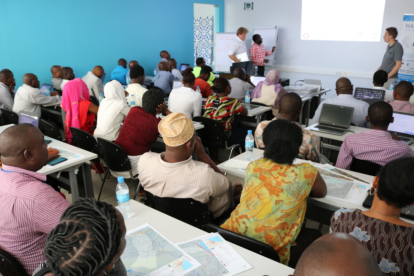
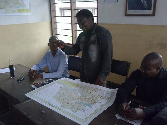
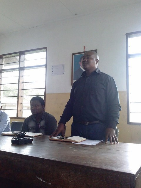
PHOTO; Presentation Session

Presentations

Participants were first introduced to OpenStreetMap – a free editable map of the whole world where anyone can view and upload/download spatial data. They also learnt about OpenDataKit Collect (ODK) – a free Android application that we use to collect information in the field mainly data points and line trace for the case of drains.

Drain Mapping Presentation.

A Hydrological consultant from Deltares in the Netherlands, Hessel Winsemius, who is developing a flood model of Dar es Salaam based on the drainage data that Ramani Huria is collecting, presented the work that he has done up to now.  Participants were really interested to see how the data produced through local methods could actually generate a sophisticated flood model for Dar es Salaam. See the previous post here on using open source tools to map drains.

Participants then witnessed a demonstration on drainage mapping. The Ramani Huria team took participants to the field around COICT grounds to see first-hand the methods that Ramani Huria uses to map drains and produce quality data.

During this experience, participants were genuinely interested in learning about Ramani Huria and expressed interest in becoming more involved in the project. The participants were also amazed that the data collected is entirely open so that anyone can download and use it for free. 

“We intend to use this data to identify high-risk areas and see how we can design better infrastructure. I was impressed to see how the flood model of Dar Es Salaam is produced by using Ramani Huria data. I think I will contact the developer of the model to learn more”.  Aidan  Mhonda- Assistant Lecturer, Ardhi University. 

QGIS Training

Participants were then introduced to open and free software that can be used for mapping. We installed QGIS software onto attendee’s computer and made sure that they all knew how to add shapefiles, change styles, categorise and duplicate layers of the map. The aim of this exercise was to offer a general introduction to all and encourage those who are interested to learn more about it. 

“The workshop has added value to my daily activities, for example using QGIS to produce maps in just five minutes in contrast to the programme that I was using which takes up to 30 minutes to compose a map. With QGIS plugins it’s much easier” Haroun Bakari Commission of Science and Technology (COSTECH) representative.

Some participant did not believe that flood maps can be produced, they come to realise it during the workshop.

“It’s interesting to see people mapping for floods, it’s not often mapped by many professionals. I’ve seen fantastic Ramani Huria Atlases and I am amazed how Ramani Huria can blend new technologies with a community participatory approach. Seeing the use of multiple layers of data and being able to establish trends that helps us to study flood-prone areas that are freely available to anyone is very interesting. Now I know that there is good data out there which I can use for different purposes” he continued.

ODK Form Building 

Participants were trained on how to create ODK forms using XLS. This exercise was facilitated through an in a participatory format – community members were asked to write down on sticky notes what problems they faced in their daily activities that they thought Ramani Huria could help to solve. From participant responses, one was chosen as a case study to build an ODK form together with the attendees. 

“When I first heard about the workshop I was really happy that I could get to know more about Ramani Huria. Apart from the Drain Modelling the most interesting part to me was ODK form building, and I will apply this knowledge to my students at the university for them to use ODK during their fieldwork data collection for their dissertations. My point here is not for students to simply collect data but to be able to analyse and use this data for decision making such as using data to design housing development projects”. Aidan  Mhonda- Assistant Lecturer, Ardhi University.

Using OsmAnd Application and Map Reading

Community members and Wajumbe (local leaders) received training on how to read maps and how to use the OsmAnd OsmAnd (a map and navigation app for Android and iOS. It uses the OpenStreetMap map database for its primary displays, but is an independent app and not endorsed by the OpenStreetMap Foundation). They were impressed to see maps of their own ward that they took part in producing via the Android application. Community members were able to locate their areas of residence on a map and navigate their routes to work.
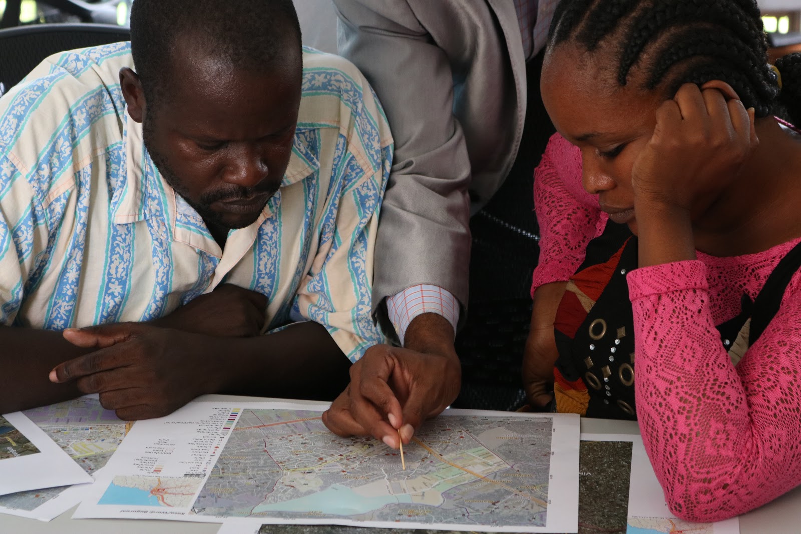
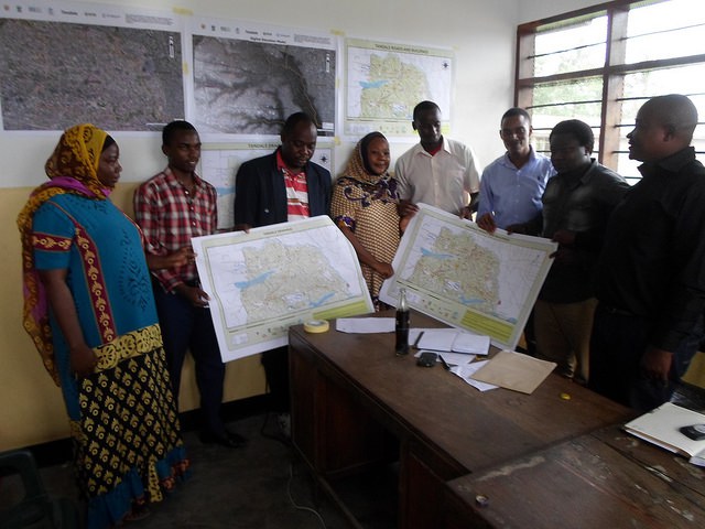
PHOTO; Community Members reading a map during the workshop.

General Discussion on Stakeholders Involvement

There was a general discussion on stakeholders involvement and how we can involve these actors to improve impact on communities that are suffering from floods. The conversations were based around open (free) data and how the government could be further encouraged to provide support to initiatives, like Ramani Huria, that enhance community resilience from a ground-up approach.

The  discussion was based on three major questions

  • Why should we collaborate with you? 
  • Why should you collaborate with us?
  • How can we collaborate?

Eight institutions were willing to fully collaborate with the Ramani Huria project. These include Municipal Councils, the National Bureau of Statistics (NBS), the Energy and Water Utility Regulatory Authority (EWURA), the Ministry of Health, the Ministry of Water, educational institutions, Tanzania Petroleum Development Corporation (TPDC), and Tanzania Rural and Urban Road Agency (TARURA). 

Participants expressed their views on what they feel is most important to improve cooperation and collaboration with key stakeholders in order to ensure that the data produced through Ramani Huria reaches key users for greater impact.

‘’This is open data, open software- the world is now moving from confidential/ closed information to open data, let’s accept this and collaborate’’- Engineer Natt- Former city director of Dar es Salaam. ‘’I argue that government officials should collaborate and community members take part in data collection- we can not do this without community members’’, He added.

‘’The government do not restrict to collaborate, there are different ways to involve them. The simplest way is showing them what you have done (as Ramani Huria is doing) then ask for their opinion and include the suggestions in what you are doing. This is the simplest and collaborative way’’ William Christopher- Lecturer University of Dar Salaam.

As the main aim of the workshop was to increase collaboration with and involvement of more stakeholders in Ramani Huria, most attendees suggested involving key stakeholders during the data collection process in order to increase data use and sustainability of the project.

’You need to call us to do the work together not to show us what you have done. We are ready to collaborate with Ramani Huria‘’ – Grace Kiharusi- GIS expert Dar es Salaam city council.

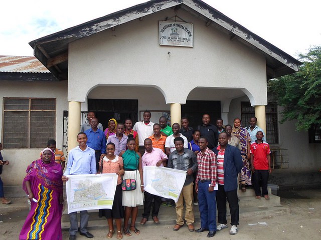
At the end of the workshop, everyone was excited and willing to take part in the Ramani Huria initiative, networking with different actors. The event was a success!

Categories
Workshop

Community discussions on flood prevention at recent Tanzania Red Cross workshop

Ramani Huria was honoured to be part of a recent workshop organised by the Tanzania Red Cross Society as part of their project Zuia Mafuriko (Prevent Flooding). The workshop took place over two days, January 19th-20th 2016, and drew together a variety of stakeholders who play a role in flood prevention in Dar es Salaam. In addition to the Ramani Huria team, participants included members of Community Disaster Preparedness and Response Teams, Kinondoni Municipal council Executive Director, Tanzania Meteorological Agency (TMA), and Ruvu Water Basin Authority. Through the workshop, the various stakeholders shared their experience and supported the development of the Zuia Mafuriko project, including planned activities for Ilala and Kinondoni municipalities.

The workshop was officially opened on January 19th by the Kinondoni Municipal Council Executive. Also present was Nyambiri Kimacha from the Tanzania Red Cross Society and project manager for the Zuia Mafuriko project. She stated that the project will assist in the development of disaster preparedness and response plans for ten wards within Ilala and Kinondoni municipalities. The wards are some of the most flood-prone in Dar es Salaam and include Ndugumbi; Tandale; Buguruni; Magomeni; Hananasif; Mwananyamala; Vingunguti; Kigogo; Manzese; and Mzimuni. Through a partnership with Ramani Huria, the Tanzania Red Cross Society has been able to identify the most relevant wards for the Zuia Mafuriko project and has begun the work with valuable data about the selected areas. The work of Zuia Mafuriko is complementary to that of Ramani Huria, with both working towards providing citizens with data about their communities and improving flood resilience within Dar es Salaam. 

Through a presentation entitled ‘Understanding the Weather Forecasts’, Elias Kipika from the Tanzania Meteorological Agency (TMA) gave the workshop an introduction to the wider context of the Zuia Mafuriko and flooding in Dar es Salaam. He stated that there is a limited understanding among the general population regarding weather forecasts, especially when warnings are issued for precautions to be taken. Following his presentation, the attendees discussed some of the challenges of disseminating weather forecast information, including issues arising when people may not have radios or TVs and therefore cannot be reached and informed through traditional communication channels. Elias Kipika acknowledged these challenges and highlighted ways in which his agency has begun innovative approaches, including an SMS service to target agriculturalists. Community members from the wards in which Zuia Mafuriko will operate also shared their experiences of flooding within their communities.  

Zuia Mafuriko workshop participants in a discussion session PHOTO CREDIT: Ramani Huria

To conclude the first day, the workshop participants formed five smaller groups of five people for ‘Tough Talk’ sessions. The sessions were designed to facilitate each group to discuss and answer questions within a time limit around flood risk management – to quickly identify issues and opportunities for flood resilience in Dar es Salaam.

A participant presenting the findings of their ‘Tough Talk’ discussion session to the workshop group PHOTO CREDIT: Ramani Huria

At the conclusion of the ‘Tough Talk’ sessions, each group presented their responses to the other workshop attendees. The key findings were displayed on the walls and these facilitated further discussions with other groups.

A workshop attendee presenting their preparedness action plan for when a long-range weather forecast is issued PHOTO CREDIT: Ramani Huria

The second day was focused on the theme of ‘Preparedness action planning’, with attendees developing action plans for when weather forecasts are issued. Three groups of around eight participants assigned either short, medium, or long term forecasts. The groups created a list of actions to be undertaken if their respective forecasts were to be issued, including predicted associated costs, identifying responsible action centres, and expected time for each action. The groups then presented their ideas the rest of the workshop and received feedback on their action points and whether the plans accurately responded to short, medium, or long-range forecasts.

The workshop was closed with remarks on the way forward for the Zuia Mafuriko project. Those present were told that the plans they had created and the issues discussed throughout the workshop would be shared with the Ilala and Kinondoni Municipal Councils as they create their preparedness and response plans. Future workshops will be planned and the project aims to have continued community and stakeholder engagement.

The Ramani Huria team is excited for the future activities of Zuia Mafuriko and our continued partnership with the Tanzania Red Cross Society on flood prevention across Dar es Salaam.

Categories
Workshop

Scale Up Workshop – 6th July 2015

Attendees at the Scale-Up Workshop gather outside Nkrumah Hall. PHOTO CREDIT: Humanitarian OpenStreetMap Team

The Dar Ramani Huria Scale Up Workshop took place at Nkrumah Hall, University of Dar es Salaam, on Monday 6th of July. Over the next three months, the Ramani Huria project ‘Community Mapping for Flood Resilience’ will be building on previous work and expanding mapping of additional wards across Dar es Salaam.

The scale-up will be lead by a group of fifteen students who have been trained by the Humanitarian OpenStreetMap Team (HOT) and previously worked with community members to map Ndugumbi, Tandale, and Mchikichini wards. HOT staff on the project are Paul Uithol (project manager), Geoffrey Kateregga (lead mapping supervisor), Steven Bukulu (mapping supervisor), and Sophie Lafayette (media specialist). In the coming weeks, the project with involving an additional 140 university students from the University of Dar es Salaam (UDSM) and Ardhi University, as well as community members from across the 10 to 14 wards to be mapped. 

In the first phase of the scale-up, six wards will be mapped, including Makumbusho, Makurumla, Msasani, Mburahati and Mabibo. The wards to be mapped during the project are some of the most densely populated areas of Dar es Salaam and consist mostly of informal settlements. Settlements in these wards are also often built in flood-prone areas, leading them to be heavily affected when flooding occurs.

SOURCE: Ramani Huria (2015)

The Scale-Up Workshop consisted of two panels and a student participation workshop, with both students and ward officials in attendance. Guest of Honour at the event was Julia Letara, Municipal Town Planner for Kinondoni Municipal Council.

Guest of Honour, Julia Letara PHOTO CREDIT: Humanitarian OpenStreetMap Team

The event was opened by Dr Philip Mwanukuzi, Head of the Department of Geography (UDSM), a representative of the Principal of College of Arts and Social Sciences (UDSM), and the Guest of Honor, Mrs Julia Letara.

The first panel (L-R): M.Iliffe, J.Letara, Dr P. Mwanukuzi, H.Hambati, G.Kateregga PHOTO CREDIT: Humanitarian OpenStreetMap Team

The first panel, ‘Engaging in Flood Mapping’, began with a primer entitled ‘Our State of the Map’ by Geoffrey Kateregga, the Mapping Coordinator for HOT. The panellists included: Julia Letara (Municipal Town Planner, Kinondoni Municipal Council); Mark Iliffe (Geospatial Specialist, World Bank); Dr Philip Mwanukuzi (Head of Department of Geography, UDSM); Professor Herbert Hambati (Professor of Geography, UDSM); and Geoffrey Kateregga (Lead Mapping Coordinator, HOT). This panel gave an overview of the progress achieved by the ‘Community Mapping for Flood Resilience’ project and an introduction to mapping tools used in the project. Julia Letara, highlighted that new technologies offer exciting opportunities, including giving citizens a voice and helping inform public service delivery. 

The second panel (L-R): V. Deparday, D.Minja, K.Hamis PHOTO CREDIT: Humanitarian OpenStreetMap Team

The second panel, ‘Connecting Communities’, began with a primer entitled ‘Global Experiences of Community Mapping’ by Vivien Deparday from the Global Facility for Disaster Reduction and Recovery (GFDRR). The panellists included: Deogratias Minja (Open Data Consultant, World Bank); Vivien Deparday (Disaster Risk Specialist, World Bank); and Kamal Hamis (Ndugumbi Ward Community Member). The panel, and following question and answer session, put community mapping in the context of Dar es Salaam, specifically the way in which the data collected through mapping could be used for planning and disaster reduction. 

Following the two panels, there was a lunch break, after which students returned for a workshop on ‘The Process of Mapping’, led by the team from HOT.

Students in the practical workshop PHOTO CREDIT: Humanitarian OpenStreetMap Team

The first part of the workshop began with an introduction to mapping techniques. To further boost the project activities, HOT has acquired two drones for the project from senseFLY, which will help provide high-resolution aerial imagery that will make mapping easier and more accurate. Included in the workshop introduction was a short demonstration and overview of the drones. The second part of the workshop allowed the students to experiment with mapping techniques and put their initial training into practice.

Following the Scale-Up Workshop, students were given complete training in mapping tools and techniques (July 7-9th), before the commencement of mapping (July 13th). The course materials used are available on the project’s Github repository, at https://github.com/hotosm/RamaniHuria.

Categories
Workshop

Closing Community Forum in Tandale Ward

Mapping activities in Tandale were wrapped up at the Community Forum at the ward office on May 29th, 2015. In Tandale, five weeks of mapping work have been performed by community members of this ward and Ardhi University students, from April 21st 2015 until May 22nd.

The Community forum officially delivered the maps of Tandale. Ward officials were presented with maps of the roads, buildings and drainage network.

Two media outlets were present to cover the event, The Guardian News Paper and the television station Channel Ten. Opening remarks were made by one of the ward officials, Mr Kalema, at 10:30, who welcomed the audience and thanked all the participants for volunteering towards having Tandale mapped up to date.

After Mr Kalema, the ward officer Mr Osiligi spoke: “Administrative work has been made clearer and easier for the Tandale ward office; now we can make better proposals with clear evidence with the use of these maps”. He added that these maps will not only help the ward office but all the people of Tandale. And even far beyond, since the information is open source and can be accessed freely through the www.openstreetmap.org website.

Different technological ideas, methods can be developed by the people of Tandale due to this data to help with flood resilience. Wetlands are clearly shown so people can avoid or evacuate these areas due to the dangers that may come about during heavy rains. Additionally, road networks have been made clear thus making easier navigation in Tandale. “We can benchmark on this information to make Tandale a better place than it is right now.”

Discussing what comes after mapping in Tandale CREDIT: Ramani Huria

“Now we have the maps, what comes next?”. This important question was raised by Mr Daniel, a sub-editor from The Guardian Newspaper. Deogratius Minja, representing the World Bank, gladly answered the question during his speech: “Towards the end of the project with all this data available online, maps clearly indicating realistic natural hazard areas and impact scenarios will be produced. This will allow for better planning, preparedness, and response activities using InaSAFE software which is free to download and is open source. The community will come to appreciate the importance of our activities by seeing all these maps”.

Deogratius Minja, representing the World Bank discusses what comes after mapping CREDIT: Ramani Huria

Geoffrey Kateregga from the Humanitarian OpenStreetMap Team told the audience that Ramani Huria is increasing capacity for open data collection by training University students and community members in mapping skills which are being put into effective use for risk analysis.  

Innocent Maholi, a student from Ardhi University also got to describe the mapping process, he said, “With a combination of GPS Units, Field papers and JOSM software we were able to update Tandale onto the free editable map of the World, OpenStreetMap. We were provided with clear drone images which are up to date plus easy to collect data with”.    

Mr Salim Mtepetallah, who represented the community members, promised to continue with the mapping since now they have the skills, plus encouraging more people to join the mapping community by training them how to map.

Community members discuss mapping and Tandale ward CREDIT: Ramani Huria

An open discussion followed which had the audience give their views about the project and how it will help with flood resilience. Mr Nassoro Mzee, a community member, explained that the unplanned settlement in Tandale has greatly contributed to floods in Tandale during rainy seasons. People have constructed their houses over water drains, ditches, and in wetlands. To make it even worse, there is poor waste disposal from their residences; most just dump it outside, where it ends up blocking the few available drains that would have helped drain the water to larger water channels. With the availability of these maps, including those that clearly show the drainage network in Tandale, more effective settlement planning can be done in the future to make Tandale better than it is today

The Ramani Huria team officially handed over the maps to the Executive ward officer accompanied by two sub-ward officers. All community members that participated in the mapping activities were awarded Certificates of Participation for their efforts to make this a success.

Community members receive printed maps of Tandale ward CREDIT: Ramani Huria

Closing remarks were given by Steven Bukulu, who acknowledged the presence of the media houses that will broadcast this to the entire nation. The Guardian News Paper will publish an article on Monday 1st June 2015 while Channel Ten will show it in the 7:00 pm evening news, Saturday 30th May 2015. A group photo was taken outside the ward office to wrap up the event.

Community members and Ramani Huria at the Tandale ward office CREDIT: Ramani Huria

Next week, we will start off in Mchikichini, the next ward to be mapped and updated on OpenStreetMap!