Categories
Mapping

Red Cross Volunteers Active in Mapping Vingunguti

Vingunguti is an administrative ward in Ilala district in western Dar Es Salaam and according to the 2012 census has a population of 106,946. Vingunguti ward is a flood-prone area of Dar es Salaam and many settlements within it are informal. The Msimbazi River flows around the West and North boundary of the ward, and during the rainy season is a major cause of flooding.

Launching mapping in Vingunguti

Ramani Huria launched mapping in Vingunguti with a community forum taking place on 11th September 2015. Red Cross volunteers were excited to be present at the event, with the Ward Community Executive Officer Mr Msimi, and community members from eight sub-wards, including Mtambani, Kombo, Mtakuja, and Miembeni. Also in attendance were representatives from the World Bank, Humanitarian OpenStreetMap, and university students from Ardhi University and the University of Dar es Salaam. 

Vinginguti_before_2015-06-01.jpg
Vingunguti ward before mapping SOURCE: OpenStreetMap

Vingunguti ward includes many flood-prone areas and Red Cross volunteers shared their experiences of flooding in the ward during 2011 and 2015. One story shared by Mzeee Hamis was that in 2015, floods led to the death of five people and buildings within the ward were so heavily flooded they have been abandoned. He noted that due to financial resources current initiatives against flooding are severely limited. Mr Said Mwikala also shared his experiences, noting that on the 4th of April Vingunguti hospital was completely flooded, with drains overflowing and offices and wards of the hospital being severely affected. As a result, in one case, a pregnant woman had to deliver outside the labour room as it inaccessible and full of water. Ambulances were unable to bring the sick to the hospital, and the facilities were not functional for more than twelve hours. He noted that the flooding in April of this year was disastrous, with high costs to property and loss of life. 

Mapping Vingunguti

Assisting in the mapping of Vingunguti by Ramani Huria, the Red Cross volunteer group divided into two groups, each with ten volunteers, and each group worked with other community members and students involved in the mapping of the ward. The first group were active from 14th September to 18th September, and in collaboration with experienced student mappers, began data collection with GPS units. The second group were active from 21st September to 25th September.

While many residents were enthusiastic and supportive of the mapping project, the Red Cross volunteer teams did encounter some challenges. Power shortages made it difficult to digitalise the collected information in a timely manner and the changes in the availability of the room supplied by the ward office meant that activities had to occasionally relocate to the nearby Kombo Primary School. 

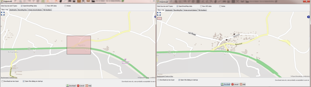
While some challenges were faced in mapping, the students, community members, and Red Cross volunteer all worked hard to complete mapping of the ward on time. Over two weeks the Ramani Huria team, including Red Cross volunteers, mapped the entire ward, including sub-wards of Kombo; Mji Mpya; Faru, Mtambani; Mtakuja; Butiama; Miembeni; and Majengo. Key features such as roads, buildings, drainage channels, and flood-prone areas, were all included in the mapping.

Completing mapping in Vingunguti

Vingunguti ward after mapping

Mapping was completed in the ward and closed with a community forum on the 9th of October. Maps were presented at the ward, a general map and drainage specific map, and those participating in the mapping received certificates of achievement. 

vinguguti_closing.jpg
Maps presented in Vingunguti ward PHOTO CREDIT: Ramani Huria

The maps were presented to the Ward Executive Officer, Mr Msimi, to provide Vingunguti ward with the tools to enable improved disaster planning and response to flooding. 

Read more about Vingunguti ward on the Ramani Huria website and all data collected on the ward is available from Ramani Huria and on OpenStreetMap.

Categories
Uncategorized

Ramani Huria volunteers support #HapaUsafiTu

Independence Day and Republic Day in Tanzania falls on the 9th of December, typically a day off work with many people gathering at the National Stadium to watch parades match in front of the President. Dances are performed and a torch is carried up Mount Kilimanjaro, symbolising liberty and self-determination of the nations in Africa. However, in 2015, for the first time, the day will be celebrated in a very different way.

Recently elected, President Magufuli declared that celebrations of Independence Day and Republic Day would be a chance for all citizens of the country to clean their local environment, from offices to schools, streets to homes. With support from all Government departments & agencies, many private organisations and non-governmental organisations also participated in the efforts – including Ramani Huria! The efforts were named #HapaUsafiTu (Here is just cleaning), reflecting the slogan of the recently elected president, ‘Hapa Kazi Tu’ (Here is just work). 

Ramani Huria and Red Cross volunteers taking part in #HapaUsafiTu PHOTO CREDIT: Ramani Huria

Ramani Huria volunteers participated in #HapaUsafiTu in several of the wards we have conducted mapping, including the wards of Ndugumbi, Tandale, Vingunguti, Manzese, Mzimini, Kigogo, Mwanayamala, Buguruni, Magomeni, Manzese.

Volunteers working hard to clean streets PHOTO CREDIT: Ramani Huria

As well as cleaning activities, including bus stands such as Chama in Buguruni, the volunteers engaged with residents of the wards on the importance of sanitation. Recently Dar es Salaam and several areas of Tanzania has seen outbreaks of Cholera so the cleaning efforts could not come at a more important time. With many wards of Dar es Salaam being highly populated and unplanned, much of the population is it a high risk for the outbreak of disease, especially in the rainy season. The volunteers discussed with community members how best to maintain the cleanliness of areas, specifically clearing rubbish and keeping waterways and drains free of blockages. 

Cleaning in Kigogo ward, one of the areas Ramani Huria has mapped PHOTO CREDIT: Ramani Huria

After a day of intensive cleaning, it was apparent that this day of work had had a big impact on the city of Dar es Salaam. Through the discussions we had with community members, many people felt that there should be similar days in the future and had plans to request from the local administration that there be additional cleaning activities. Ramani Huria and the volunteers from Red Cross and HOT were all pleased to be able to continue to support the wards we have been actively mapping. 

Categories
Mapping

Putting Dar es Salaam dala dalas on the map

For many residents of Dar es Salaam, taking the dala dala is an everyday necessity. With over 200 routes across the city, dala dalas are medium-sized buses providing the cheapest way to move around and essential transportation for many. As one of the fastest-growing cities in the world (the third largest in Africa and ninth in the world), Dar es Salaam’s population of 4.3 million is expected to increase to 7 million by 2025 and transportation is, and will continue to be a factor in the quality of life for residents. Transportation routes in Dar es Salaam are severely affected during the seasonal flooding, with many roads becoming impassable and public transportation ceasing. Including roads and other transit features in our mapping data is vital in assisting Ramani Huria (and anyone using the data we collect) to more accurately assess the impact of flooding in the city and improve flood resilience. 

Mappers collecting data on the dala dala routes PHOTO CREDIT: World Bank

When mapping dala dala routes, the Ramani Huria team knew that the process would be challenging due to Dar es Salaam being a fast-changing and sometimes chaotic city. To ensure the data collected was accurate and reflective of routes actually used by dala dalas, we utilized a number of sources, including local community knowledge. During the mapping of dala dala routes, Ally, a German company that has created an app to help use public transportation, were visiting Tanzania. Given their expertise in providing local transport planning and real-time transit data they were extremely interested in being part of our work and joined our volunteers in the mapping process.

Following the identification of key transportation hubs, our mapping volunteers physically traveled all the dala dala routes identified. Volunteers had either a smartphone tracking app or GPS device and tracked their assigned route from starting point to the end, and then back. At the end of the first stage of mapping, when all routes had been surveyed, information on 243 routes had been collected!

To view the transport map on OpenStreetMap, click layers on the right hand side and select ‘Transport Map’ SOURCE: OpenStreetMap

When all the required data had been collected, Ramani Huria, the Tanzania Open Data Initiative (TODI) team from the World Bank, and Ally, worked together to develop a process to clean up the data and import all routes tracked into OpenStreetMap – allowing the routes to be freely available for anyone to access online. The routes can now be seen on OpenStreetMap by selecting the ‘Transport Map’ from layer options.

243 dala dala routes mapped across Dar es Salaam SOURCE: Ally
243 dala dala routes mapped across Dar es Salaam:
 http://allyapp.com/dar-tracking-viz/# 

Ally then further processed the data and imported it into their app, making Dar es Salaam one of the first African cities with a public transit map available on smartphones. Other forms of transportation, including ferries and trains, are also included in the app, and the Bus Rapid Transit (BRT) system will be included when launched. You can view a visualisation of all the dala dala routes mapped here.

Working with Ally was a great experience for Ramani Huria and the data collected through the dala dala mapping will be valuable in our continued work to map Dar es Salaam and efforts for flood resilience.

Download the Ally app here for iPhone and Android.

Categories
Mapping

Mapping drainage in Dar es Salaam

Collection of waterways and drainage of Dar es Salaam in progress IMAGE CREDIT: Mapbox/OpenStreetMap (markiliffe)

Every year during the rainy season, Dar suffers from devastating floods that wipe out roads, destroy houses, and result in deaths, sickness, and millions of dollars worth of damages. By helping communities to map their wards, Ramani Huria is able to support disaster prevention and response to areas that were previously off the map, literally. One key element of these maps is drainage systems. We have dedicated mappers working to ensure these, as well as wetland zones and flood-prone areas, are included accurately in our maps.

Some areas of Dar es Salaam are known to be flood-prone due to their physical features, however, in certain cases, it is difficult to differentiate between areas which are affected by floods and those that are not. Changeable factors such as drainage also contribute to how an area is affected by flooding. However, some areas such as the Msimbazi valley are consistently affected by floods. In this area residential, industrial and agricultural activities are affected every year by flooding. 

The Ramani Huria drainage team is working to add these details to OpenStreetMap and all the maps we create, below is a snapshot of their drainage mapping activities from September 17 to October 6 2015. 

Drainage mapping diary

17th September 2015

We observed that many roads do not have open drains running alongside them. In Msasani ward, especially Masaki and Oysterbay sub-wards, we found no drains at all by the roads. However, this does not mean that drains do not exist, or that there is no flowing rainwater and flooding during the rainy season. 

Example of a road without drains next to them in Msasani ward PHOTO CREDIT: Ramani Huria

28th September, 2015

This week drainage mapping was done in Sinza ward and along University Road around Ardhi University and University of Dar es salaam. In Sinza, mapping of drainage was done specifically along Shekilango Road, Mori Road, and Sam Nujoma. The key issues we observed were that drains were blocked by solid waste and many areas lacked drains, especially the gravel roads. 

Dumping of solid waste in drains at Africa Sanaa along Shekilango Road PHOTO CREDIT: Ramani Huria

We also saw the construction of buildings over streams, for example at Sinza Mori near Big Bon filling station there are commercial buildings (a bar and saloon) built above a stream.

Construction over streams in Sinza Mori PHOTO CREDIT: Ramani Huria

29th September-1st October 2015

We focused on mapping drainage systems along with trunk wards, including Kilwa Road, New Bagamoyo Road, Morogoro Road and Mandela Road. These roads are key in connecting the city to other regions of the country; therefore it is vital to know how these areas may be affected by flooding and water flow. Mandela Road specifically is a key road as it is connected to the Dar es Salaam port, affecting the flow of goods and people as all cargo vehicles from the port must pass via this road. 

Part of Morogoro Road in Mzimuni showing drainage system and existing situation PHOTO CREDIT: Ramani Huria

1st October 2015

In Kijitonyama ward we observed that many buildings are built over water streams or very close to the waterways. We have seen residential buildings being built close to streams as a common problem in unplanned settlements across the city. These structures result in the water not being free to flow and can lead to the buildup of water, increasing the effects of flooding. 

Residential buildings in Kijitonyama ward built close to streams PHOTO CREDIT: Ramani Huria

2nd October – 6th October 2015

Many drains, ditches, and streams are blocked by sand and other accumulated rubbish, restricting the flow of water. In some areas this may be also be due to drains and ditches being used as dumping sites, with road users not properly disposing of garbage. During the rainy season, these blockages are likely to lead to flooding – the blocked drainage system cannot allow for rainwater to flow out of the city.

Blocked drains in Kijitonyama ward  PHOTO CREDIT: Ramani Huria

In addition, to build up of sand and other solid materials in the drainage system, we observed along New Bagamoyo Road that dirt from natural vegetation has also built up in the ditches, drains, and streams, adding to the debris that can block the flow of water. 

Natural vegetation in drains along New Bagamoyo Road PHOTO CREDIT: Ramani Huria

Without efforts to keep drains clear of debris, through management and maintenance activities, flooding is likely to occur, or be more severe, even in areas which are not in the flood-prone zones of the city. 

Drainage mapping data

Data collected through our drainage mapping activities are uploaded onto OpenStreetMap and will continue to be updated as the Ramani Huria project continues. You can explore the drainage specific map

Mapping of the drainage system and waterways within the city will continue throughout the Ramani Huria project. It is done with the aim that this data will be useful in city planning and sanitation activities. 

Categories
Mapping

Mapping complete in Kigogo, Manzese, Vingunguti, and Mzimuni

Maps are presented to community members in Kigogo (left) and Vingunguti (right) wards PHOTO CREDIT: Ramani Huria

Closing community forums took place in four wards of Dar es Salaam on Friday 9th of October. Mapping was completed in the wards of Kigogo; Manzese; Vingunguti; Mzimuni.

Four wards prior to mapping, clockwise from top-left: Kigogo; Manzese; Vingunguti; Mzimuni.  PHOTO CREDIT: Ramani Huria

The four wards were mapped during September and October by students (from University of Dar es Salaam & Ardhi University), volunteers from the Red Cross, and community members from each ward. 

The closing community forums were attended by representatives of each ward, community members, students, and others involved in the mapping process.

Discussions on the use of maps in Manzese ward PHOTO CREDIT: Ramani Huria

The community forums provided a space for those involved in the mapping process to discuss their experiences. Community members and ward officers also discussed the possible uses for maps in the future, especially with regarding flooding and sanitation. 

Four wards on OpenStreetMap following mapping, clockwise from top-left: Kigogo; Manzese; Vingunguti; Mzimuni  PHOTO CREDIT: Ramani Huria

The four wards all went from having very basic maps to highly accurate and sophisticated maps of each ward, including information about: roads; buildings; drainage; and key points of interest such as hospitals, religious buildings, hotels, shops.

Community members and ward representatives in Mzimuni ward receive maps and certificates of participation  PHOTO CREDIT: Ramani Huria

Maps and data for each of the wards are freely available on the Ramani Huria website, and on OpenStreetMap. It is hoped that the community within the ward (as well as those in the wider international OSM community) will continue to ensure the maps are up to date, ensuring the maps provide the data needed to make planning decisions, especially relating to flood resilience. 

Categories
Mapping Party

Dodoma Mapped at Maptime Tanzania

Maptime event in progress! PHOTO CREDIT: Ramani Huria

Saturday 26th of September saw a Maptime Tanzania event take place with the goal of mapping Dodoma, Tanzania’s capital city. The event took place at the Kinu Innovation Space with over thirty people in attendance including community members, students, and techies.

David Taylor presents on what3words, with attendees testing out the app (left) PHOTO CREDIT: Ramani Huria

We had a number of special guests in attendance, including David Taylor from what3words (http://what3words.com/). what3words is aimed to give everyone in the world an address and does this by dividing the world into a global grid of 57 trillion 3mx3m squares. Each square has a 3 word address that can be communicated quickly, easily and with no ambiguity. David gave a background to the organisation as well as discussed how what3words can be applicable to individuals and organisations in Tanzania. 

Calist, Innocent, and Geoffrey from HOT start the mapping with an OSM fight, winner Innocent! PHOTO CREDIT: Ramani Huria

The Ramani Huria team gave an overview of what OSM is, and many elements of mapping, so that those new to mapping could get a brief understanding of the components. The supervisors showed us their skills with the first ‘OSM Fight’ of the day, with Innocent (@iam_innosaint) beating Calist (@evance_calist) 5-3! 

Dodoma before mapping began PHOTO CREDIT: Ramani Huria

With quite a number of new mappers in the group, the tables were organised to ensure experienced and new mappers could sit with one anything and assist in the mapping process. The city of Dodoma was divided into sections and each table assigned an area, then the race to map was on!

Dodoma at the end of the Maptime event PHOTO CREDIT: Ramani Huria

We made the day competitive and used the Open Street Map Reporter Tool (http://osm.linfiniti.com/) to track which users had contributed to most to the mapping of Dodoma. The competition was fierce with the top users constantly edging one another out of the top spots. In the end, the #MapDodomaGuru was named the as Mboya Mkundelida – congratulations! 

Attendees at the #MapDodoma Maptime event PHOTO CREDIT: Ramani Huria

It was a great day of mapping and we were proud to get our capital city on the map! The next Maptime Tanzania event will take place at Buni, on Saturday, October 17th, from 10 am. See details on the Facebook event page and sign up via Eventbrite. You can also view the details of our previous Maptime events & mapping parties on our blog

Categories
Mapping Party

Map My Hometown! 5th Ramani Huria Mapping Party

Teams at #MMHOSM CREDIT: Ramani Huria

The 5th Ramani Huira mapping party took place at Buni on the 29th of August. The theme of the event was “Map My Hometown On OSM” #MMHOSM, an opportunity to map the participants’ towns, many of which were completely unmapped.

Moshi before and after mapping CREDIT: Ramani Huria

Towns mapped on the day included parts of Mwanza, Arusha, Mbeya, Bukoba, Tanga, Moshi. Around thirty people attended the event, both students from UDSM and Ardhi University, and members of the Tanzanian tech community. The attendees were split into two teams to map the towns, with people competing to map their hometowns and have the best-mapped city.

Arusha before and after mapping CREDIT: Ramani Huria

The mapping party also showcased Mapillary, an online map and community of crowdsourced street-level photos. Mapillary also has a mobile application which is a tool in capturing photos and directly uploading them to the Mapillary map, which can be accessed by anyone.

The next mapping party will take place at Kinu on Saturday 26th of September with the theme of ‘Map Dodoma!’, with the focus of the day being mapping the capital city of Tanzania. The event is open to new and experienced mappers, with support and training provided to all. The event will run from 10 am-1 pm and updates will be posted on the Facebook event page.

Categories
Mapping

Mapping Begins in Four New Wards, Manzese, Mzimuni, Kigogo and Vingunguti

Despite the rains, the community forum opens in Mzimuni ward CREDIT: Ramani Huria

Phase 3 of Ramani Huria’s mapping of Dar es Salaam began on Friday 11th of September with opening community forums being held in Manzese, Mzimuni, Kigogo and Vingunguti.

Kigogo ward before mapping started CREDIT: Ramani Huria

Building on the work in other flood-prone wards across the city, Ramani Huria will extend mapping to four additional wards. These wards will be mapped by students from Ardhi University and the University of Dar es Salaam, in collaboration with community members from the respective wards.

Demonstration on use of field papers and GPS to Vingunguti ward community members CREDIT: @NuruKalulunga

The mapping of the wards is expected to take around two weeks and once completed, the data and maps will be presented to the community members in closing forums.

Categories
conference

Ramani Huria at the Africa Open Data Conference

The Ramani Huria team was proud to be part of the first Africa Open Data Conference, taking place in Dar es Salaam Tanzania. The event drew speakers and attendees from all over the world, to discuss, debate and showcase ‘local and global examples of open data being produced, published, visualized, and captured in creative ways across Africa.’

The conference took place over two days (4th to 5th of September) at the Julius Nyerere Convention Center, with pre-conference events taking place on the 2nd and 3rd of September at the National Museum and House of Culture.

President Jakaya Kikwete opens the conference CREDIT: Ramani Huria

The conference was officially opened by the President of the United Republic of Tanzania, Jakaya Kikwete, who in his opening remarks stated that the event signified the dawn of a new era in Africa’s transformation towards knowledge-based development. The President highlighted that open data can assist institutions, organizations, and individuals in diagnosing social and economic challenges of Nations and societies, and can inform both policy and decision-makers. Additionally, open data can be useful in monitoring and evaluating progress and impact. In his concluding statements, he noted that open data is vital to both governments and the citizens who benefit from the services provided by various institutions.

President Kikwete tours the Africa Open Data Conference expo and is shown the mapping bajaj CREDIT: Ramani Huria

In addition to opening the conference, President Kikwete toured the expo outside the main conference hall, showcasing key projects utilizing open data. Ramani Huria was proud to display our work to the President, specifically how through using local communities & students we are able to create sophisticated and accurate maps of flood areas in Dar es Salaam.

The biggest crowd-pleaser in the expo was the ‘mapping bajaj’! With support from Trimble  & Mapillary, Ramani Huria has adapted a bajaj to hold two cameras, including the Trimble MX7. The mapping bajaj is currently taking street view imagery with these cameras, which will be uploaded to Mapillary – an online map and community of crowdsourced, free and openly licenced street-level photos. Anyone can view the current (and continually updated) street views of Dar on the Mapillary website here. With the Mapillary App you can also help add to the crowdsourced map and add street views. 

Africa Open Data Conference in session CREDIT: Ramani Huria

The conference itself consisted of a number of presentations and panels through the two days, with speakers from Tanzania and across the world, all with a focus on open data in Africa. The first panel, led by Maria Sarungi-Tsehai, looked at first understanding and defining open data.

The key idea behind open data being that certain types of data should be freely available to everyone to use and republish as they wish, without restrictions from copyright, patents or other mechanisms of control. It was highlighted that the use of open data has grown within the last few years, especially in use in economic development. A number of examples of open data in Africa were spoken about, including the work being done by the Ramani Huria project.

Geoffrey Kateregga presenting how Ramani Huria is promoting open data through our mapping activities across the city of Dar es Salaam CREDIT: Ramani Huria

Geoffrey Kateregga, the Lead Mapping Supervisor in Ramani Huria, presented the project and how we are promoting open data through our mapping activities across the city of Dar es Salaam, “Of all the cities in Africa, Dar es Salaam is proud to have one of the most detailed maps on OpenStreetMap. With contributions from local community members and university students, these maps are free to anyone to access online.” He highlighted how drones have been used for the first time in Africa to produce high-resolution aerial imagery for mapping flood-prone wards in Dar es Salaam. This has ensured accurate and up-to-date data is being used to create sophisticated maps, which are in turn shared on OpenStreetMap.

Mapping supervisors from the Ramani Huria project & HumanitarianOpenStreetMap at the conference CREDIT: @TylerSRadford

On the second day of the conference, Tyler Radford, Humanitarian OpenStreetMap Team (HOT) Interim Executive Director, presented HOT’s activities in Dar es Salaam and the work being done through the Ramani Huria project. With an experience of mapping vulnerable and unmapped locations across the world, HOT is overseeing community mapping efforts in Dar es Salaam in order to map the most flood-prone wards of the city. He put the work in the context of open data, explaining that maps are created in collaboration between students and community members, produced and presented to the communities in each ward, and all finally data is freely accessible online to anyone.

For further information about the Africa Open Data Conference, speakers in attendance and all the presentations, see http://www.africaopendata.net/.

Categories
Mapping Party

4th Scale-Up Mapping Party in Dar es Salaam

IMG_3804.jpg
Participants at the Fourth Mapping Party PHOTO CREDIT: Ramani Huria

Ramani Huria held our fourth mapping party on Saturday, July 25th, at Buni Innovation Hub. Forty-eight students attended the event, primarily from Ardhi University and the University of Dar es Salaam. Mapping Parties are part of Ramani Huria’s ongoing community events with the aim of building, strengthening and spreading the use and ethos of Open Source data, specifically the use of OpenStreetMap, a free editable map of the world.

IMG_3829.jpg
Participants processing  tasks from the HOT Tasking Manager PHOTO CREDIT: Ramani Huria

This month’s mapping party focused on the HOT Tasking Manager, an incredible tool used for collaborative mapping globally by the Humanitarian OpenStreetMap Team (HOT) globally. 

The first session was led by Steven Bukulu (Mapping Supervisor in the Ramani Huria project), who explained that the HOT Tasking Manager divides up a mapping job into smaller tasks that can be completed rapidly. The tool also shows which areas need to be mapped and which areas need the mapping validated – the process of validating ensures that the areas mapped are correct and of a high standard. Steven concluded the session with a video that shows the case study of Nepal and how HOT responds to vulnerable areas that need maps that could help in disaster recovery efforts. The video shows HOT activities after a major earthquake in 2015 and how volunteers contributed to map generation/production with the use of drones, that provided high-quality imagery used for digitization.

Link to Embed: https://www.youtube.com/embed/DxYKDHbzCpg

‘Nepal Quake: Could a mapping project help with recovery’ VIDEO SOURCE: BBC

The second session, introduced the participants to Mapillary, a street view mapping application. Geoffrey a mapping supervisor from HOT explained, “Mapillary is a service for crowdsourcing street view photos. Anyone can collect photos with simple tools such as smartphones or action cameras. These photos are then combined into a street-level photo view of that particular area, are uploaded and shared on the mapillary web platform”. 

Mapilliary PHOTO CREDIT: Mapillary

For example, in the image above, collected by Ramani Huria and now available as a free and open licence, shows drains, power lines and the road, among many other features. Expanding upon the Missing Maps collaborative digitization, it could be possible for anyone to digitise these features and have the underlying data available in OpenStreetMap

Additionally, Geoffrey talked about Maptime Tanzania, which he described as an open learning environment for all levels and degrees of knowledge, supporting mappers and all those interested in learning new mapping technology and skills.

In the final session, a walkthrough session for the HOT Tasking Manager was done to get the audience familiar with the tool. “Task #1120 – Missing Maps: Dar es Salaam (drone imagery)” was picked as the area of focus. The areas have been mapped by Ramani Huria during the mapping activities and remote mapping sessions. 

Keko ward before mapping, on August 10th SOURCE: OpenStreetMap

Keko after mapping, on August 10th  SOURCE: OpenStreetMap

The next mapping party will take place on 22nd August 2015 at Buni. The theme of this mapping party will be ‘Map My Hometown on OSM’ #MMHOSM. In this session, mappers will be grouped to remote map their hometown’s region. The goal for the mapping party is to have this data available on OpenStreetMap for future social-economic development. The mapping party is open to all who are interested in mapping their community and will run from 10 am-1 pm. Updates will be posted on the Facebook event page.