For many residents of Dar es Salaam, taking the dala dala is an everyday necessity. With over 200 routes across the city, dala dalas are medium-sized buses providing the cheapest way to move around and essential transportation for many. As one of the fastest-growing cities in the world (the third largest in Africa and ninth in the world), Dar es Salaam’s population of 4.3 million is expected to increase to 7 million by 2025 and transportation is, and will continue to be a factor in the quality of life for residents. Transportation routes in Dar es Salaam are severely affected during the seasonal flooding, with many roads becoming impassable and public transportation ceasing. Including roads and other transit features in our mapping data is vital in assisting Ramani Huria (and anyone using the data we collect) to more accurately assess the impact of flooding in the city and improve flood resilience.
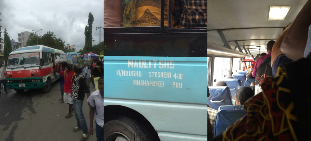
When mapping dala dala routes, the Ramani Huria team knew that the process would be challenging due to Dar es Salaam being a fast-changing and sometimes chaotic city. To ensure the data collected was accurate and reflective of routes actually used by dala dalas, we utilized a number of sources, including local community knowledge. During the mapping of dala dala routes, Ally, a German company that has created an app to help use public transportation, were visiting Tanzania. Given their expertise in providing local transport planning and real-time transit data they were extremely interested in being part of our work and joined our volunteers in the mapping process.
Following the identification of key transportation hubs, our mapping volunteers physically traveled all the dala dala routes identified. Volunteers had either a smartphone tracking app or GPS device and tracked their assigned route from starting point to the end, and then back. At the end of the first stage of mapping, when all routes had been surveyed, information on 243 routes had been collected!
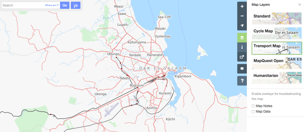
When all the required data had been collected, Ramani Huria, the Tanzania Open Data Initiative (TODI) team from the World Bank, and Ally, worked together to develop a process to clean up the data and import all routes tracked into OpenStreetMap – allowing the routes to be freely available for anyone to access online. The routes can now be seen on OpenStreetMap by selecting the ‘Transport Map’ from layer options.
http://allyapp.com/dar-tracking-viz/#
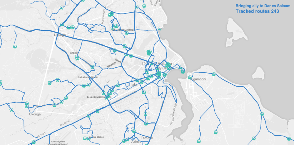
Ally then further processed the data and imported it into their app, making Dar es Salaam one of the first African cities with a public transit map available on smartphones. Other forms of transportation, including ferries and trains, are also included in the app, and the Bus Rapid Transit (BRT) system will be included when launched. You can view a visualisation of all the dala dala routes mapped here.
Working with Ally was a great experience for Ramani Huria and the data collected through the dala dala mapping will be valuable in our continued work to map Dar es Salaam and efforts for flood resilience.