Currently 70% of the infrastructure in Dar es Salaam is unplanned, meaning that structures are often built in flood areas and are not adequately built to cope with high waters. Often, even unplanned buildings that are relatively ‘safe’ from flooding have huge consequences on the surrounding area; improper planning has led to an increase of compact soil, which has low absorption rates to help disperse water during floods.
Ramani Huria is a project lead by HOT, with the aim to produce maps with the main intention of improving flood resilience planning and raising awareness of safe areas for local people. This means that future houses can be built in safe zones and that steps can be taken to reinforce or relocate buildings that are currently at risk. Moreover, it can mitigate the risk of cholera and prevent sudden displacement.
Amelia Hunt – Mapping Trainer and Project Assistant, HOT – and Zac Hill – Consultant, This is All – arrived in Dar es Salaam and have spent the last two days in the HOT office in dLab. In this blog post they outline what they have learnt about the Ramani Huria project by speaking to team members.
This blog post has been broken down into three sections: Technology, People, and Communities.
Technology
In the western world we are often faced with the perception of the developing world that has been presented by the media and development sector over the last 60 odd years – the image of poor people whose only livelihood is a small farm, travelling however many miles a day to collect water. Whilst it would be inaccurate to claim that access to better agriculture and clean water isn’t still an issue in continents like Africa, we can claim that the image is not representative of all of Africa.
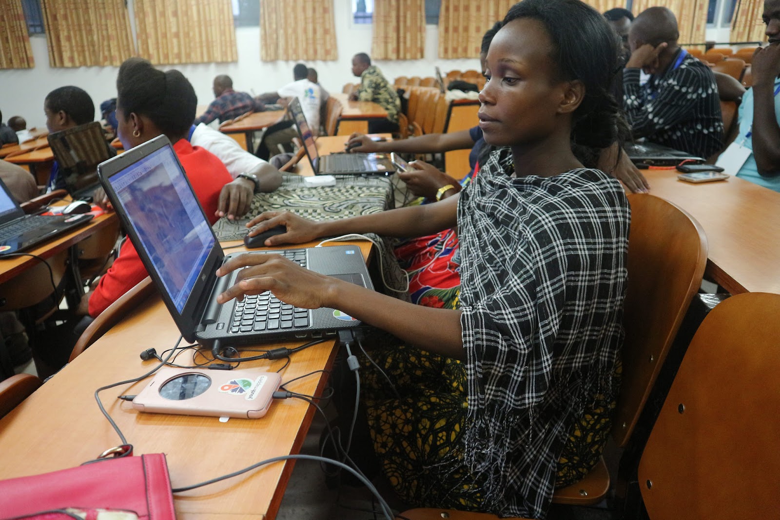
Many countries in Africa are very well connected, and Tanzania isn’t an exception. This connectivity allows ample opportunities, including the digital mapping activities performed by volunteers and staff at HOT. Moreover, all the team members we have met so far are Tanzanians, demonstrating that the traditional approach of using Western surveyors is an unnecessary expense. Armed with local knowledge, Tanzanian volunteers are able to cover more ground in less time and are able to collect more accurate data due to local language and cultural understanding.
Ramani Huria 2.0 has seen an improvement to data quality and a more structured approach to team management. Field supervisors are committed to leading their teams by example so that they can demonstrate good data collection processes, inspire participants to enjoy their work, and help them see the importance of collecting reliable, accurate data. The technology and training provided to volunteers, teamed with their commitment and passion for mapping, makes them one of the most efficient and talented digitisation teams.
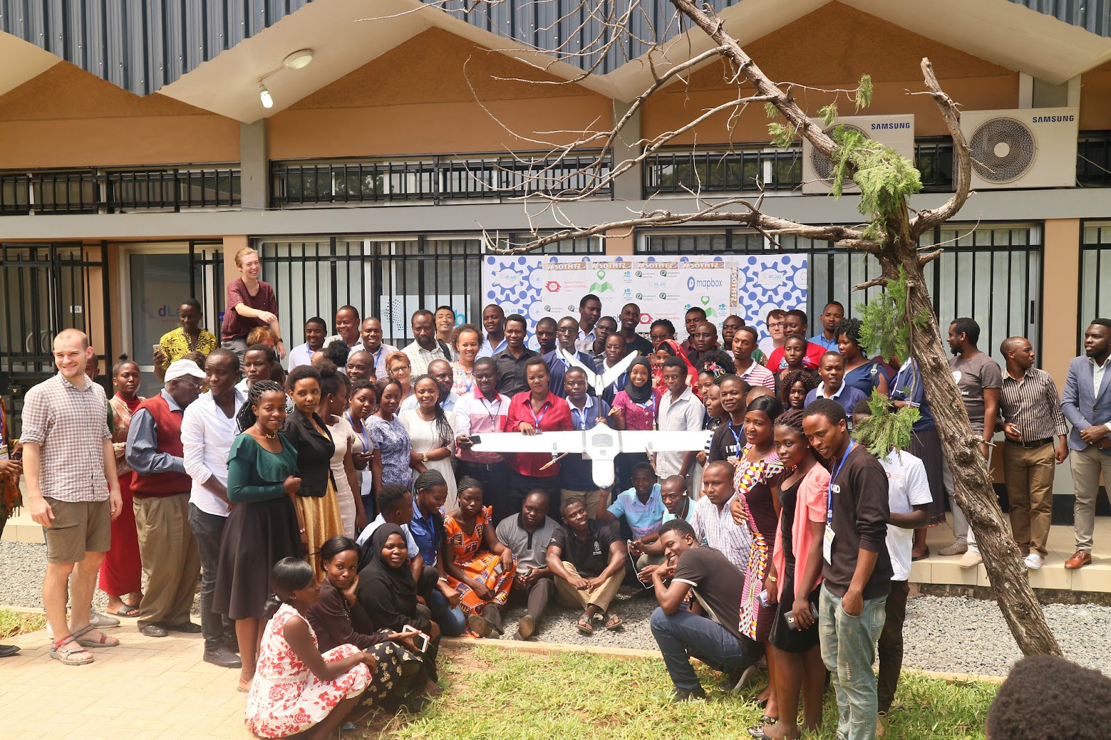
State of the Map Conference Tanzania 2017 hosted by Ramani Huria and partners which had over 170 participants
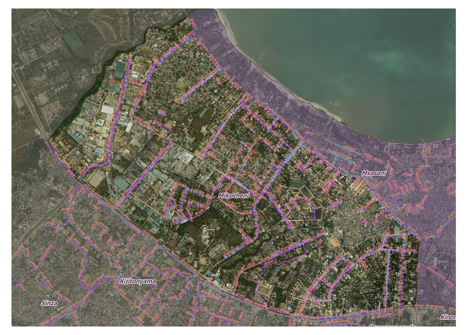
Drainage map of Mikocheni District
People
Many of the volunteers are graduates from Ardhi University in related fields who are taking part in Ramani Huria in order to improve their technical and management skills whilst contributing to improving their community. Ramani Huria is giving students the opportunity to learn new types of mapping such as using JOSM and Qgi, also the value of using community members in mapping.
Ramani Huria has been split into specific teams e.g. Drainage, Infrastructure, Community outreach etc., allowing volunteers to build up specialist skills. Sections of the project is divided into a data cleaning team and field mapping team, with supervisors who coordinate between groups to make sure that the data being collected is accurate. Speaking to the team, many of them had never been exposed to open, community mapping before. Now they feel that they can give back to their own communities whilst adding to the larger open mapping community. It is inspiring to see that after years of top-down approaches to international development, it is local people who are putting themselves on the map.
Mapping participants at State of the Map Tanzania
Communities
There is still a long way to go in terms of training the local community to understand how to use the maps. However, from what the team says, the communities do seem to be receptive when the field teams explain what they are doing when measuring the drainage systems in the city. The field teams are working hard to help local people understand the concept behind the projects and how maps can improve development initiatives and emergency response. The vision is for maps to be used by every ward and sub-ward leader to better support their local community so that people are able to locate themselves and the services they need e.g. health centres, schools, bus stations.
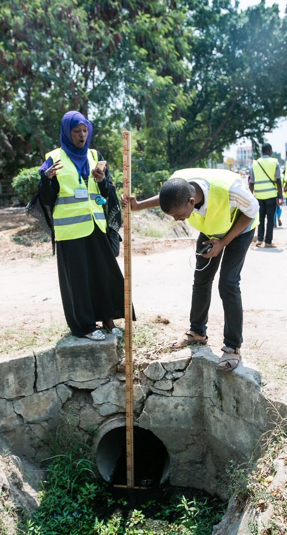
Field data collection team measuring drains and working with local community members
Overview of Initial Thoughts
While the initial motivation for the Ramani Huria project was to improve flood resilience in Dar es Salaam, it is clear that there are other benefits to the project. The project is upskilling the local people who are involved in the mapping, as well as creating a community of mappers. The way the projects operate encourage collaborative community working, which is a refreshing way to run a developing project.