Categories
Uncategorized

Mapping At Scale

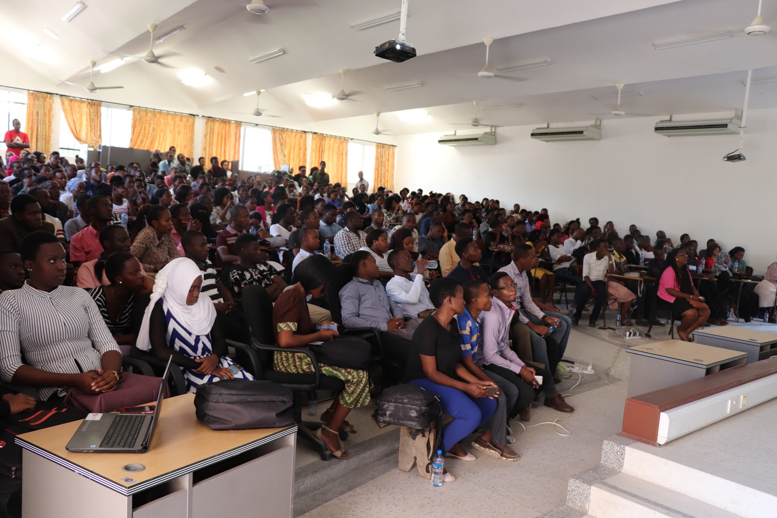
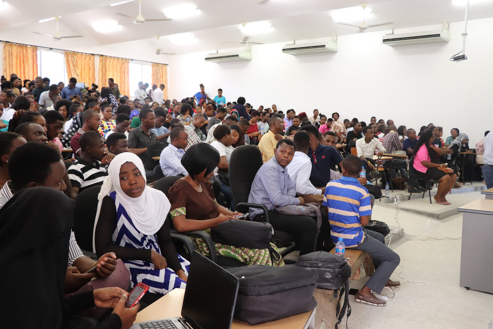
The new and expanded Ramani Huria 2.0 team, with just over three hundred students, is now getting to work with the practical work of field data collection and editing the digital map of Dar es Salaam.

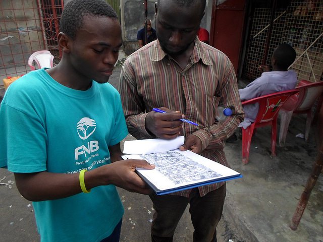
We’ve installed OpenDataKit (ODK), a free software toolset for data collection on Android smartphones. We’ll be using some more sophisticated data collection systems such as OpenMapKit, a variant of ODK that allows direct interaction with OpenStreetMap data, but the venerable and mighty original ODK is a great place to start. We begin with practice surveys at in the grounds around the D-LAB.

IMG_0431.JPG

Students Using Odk In The dLab’s Compound

Using ODK, anyone can collect GPS points of reasonable accuracy, sufficient for many type of surveying, as well as record sophisticated survey responses that can include text, numbers, selections from a menu of choices, or even photos! The possibilities for collecting well-organized data on mobile phones are amazing, and the students are astonished when we are able to immediately show them the results of their work on a map.

Water tank map at CoICT campus.jpeg

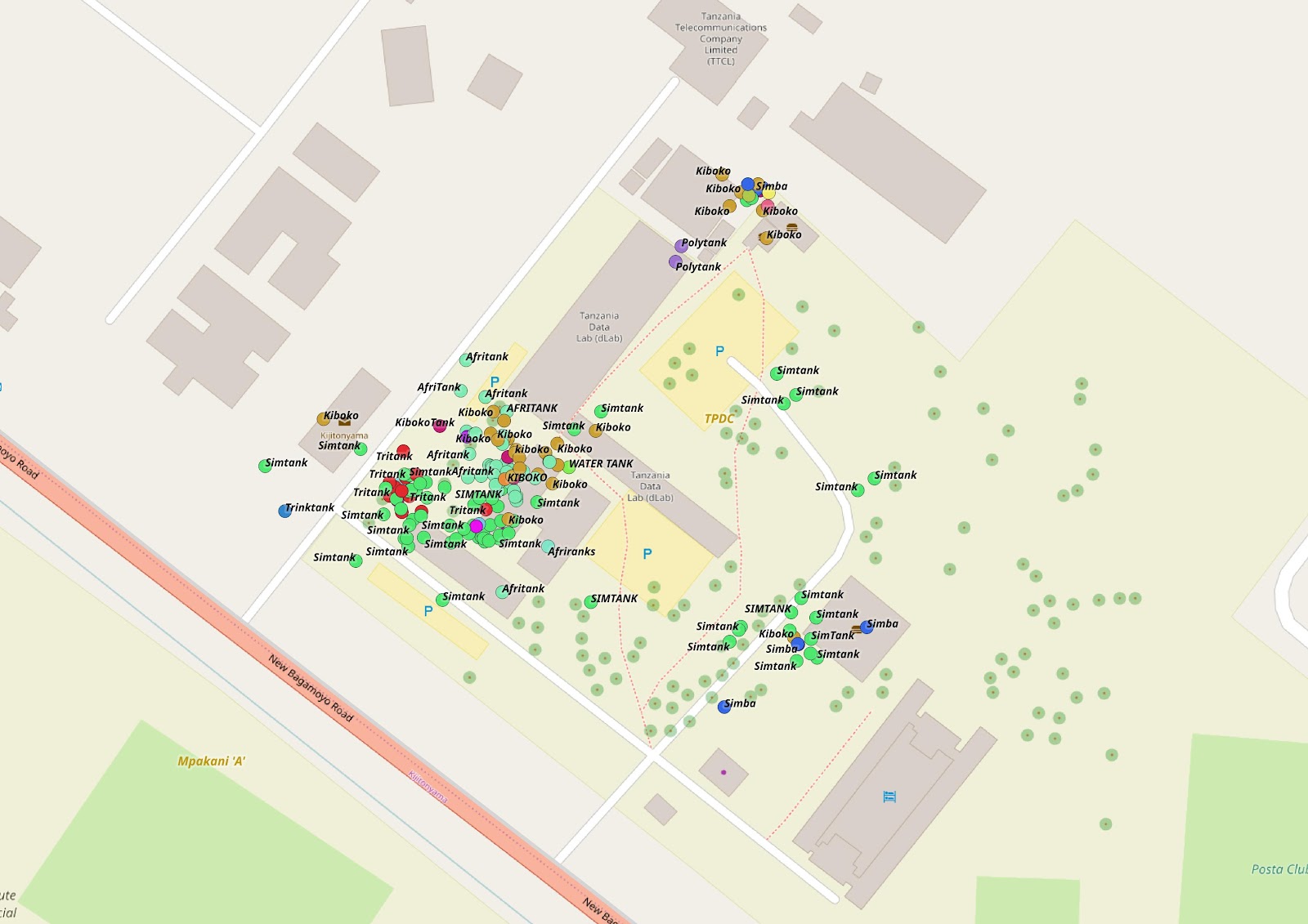
Water tanks data collected by students around CoICT, University of Dar es Salaam

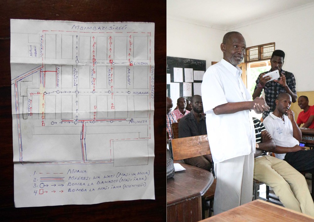
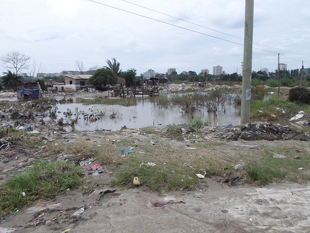
We sent the students home on Friday with a practice “homework” survey, asking them to visit their neighbours over the weekend and ask a series of questions about what kind of home people occupy, what Ward and Sub-Ward they live in, whether they’ve experienced flooding, how/where they get water, and what type of toilets they use. This survey is purely for practice (and the students are instructed to tell their neighbours this to ensure that undue expectations are not created), but generates a fascinating snapshot of a surprisingly wide area of Dar es Salaam. To our surprise and delight, over 900 surveys are completed over the weekend!

Household water sources zoomed image credit OSM.jpeg

Map Of Homework Surveys, Captioned With Household Water Source

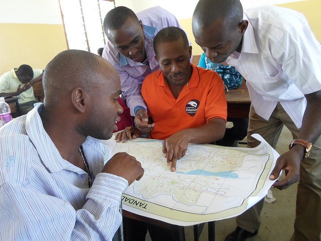
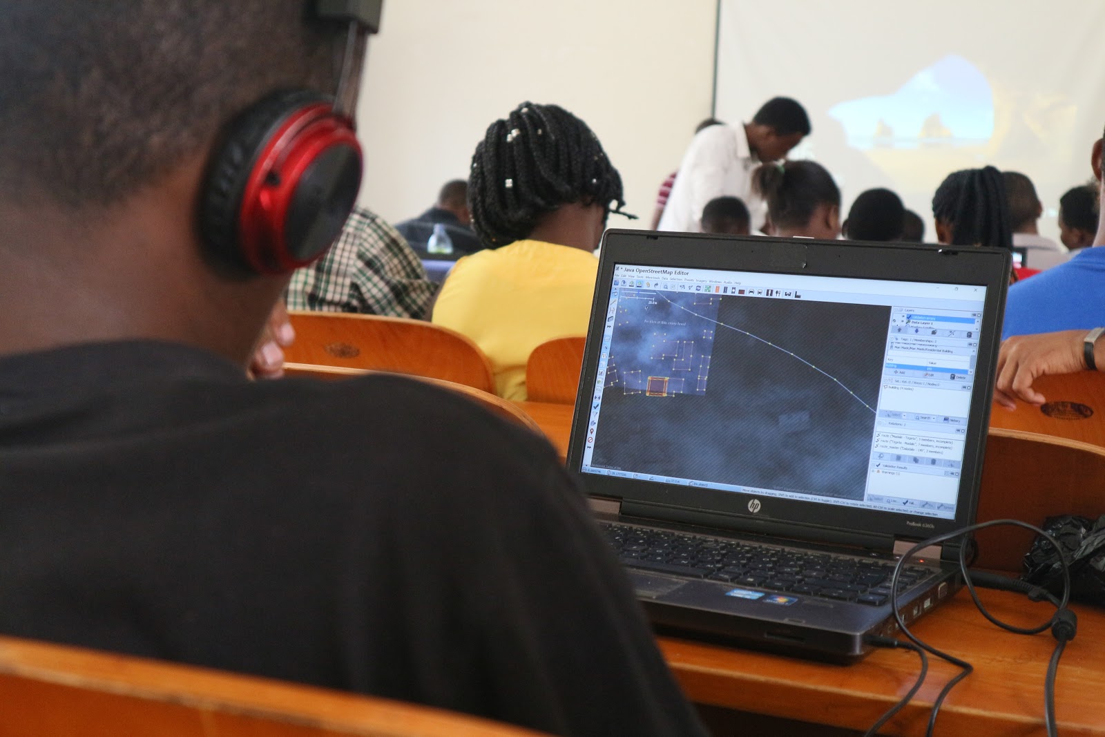
On Monday, we move out of the amphitheatre and return to four classrooms at Ardhi University, where we begin training students on the use of the Java OpenStreetMap JOSM editor, which allows anyone with a laptop to add features to OpenStreetMap. Ramani Huria has the ambition to put every building in Dar es Salaam on the map, so we begin immediately with digitization (tracing) of buildings from aerial imagery. From Monday noon until the end of the afternoon, 204 students with laptops (assisted by the remaining hundred students who watch and critique over the shoulder) add over 16,000 buildings to the map! While putting every building in the city on the map is a huge task, and we don’t know if we’ll be able to do it, but this preliminary result is very encouraging.

tasks coverage.jpeg
IMG_0721.JPG

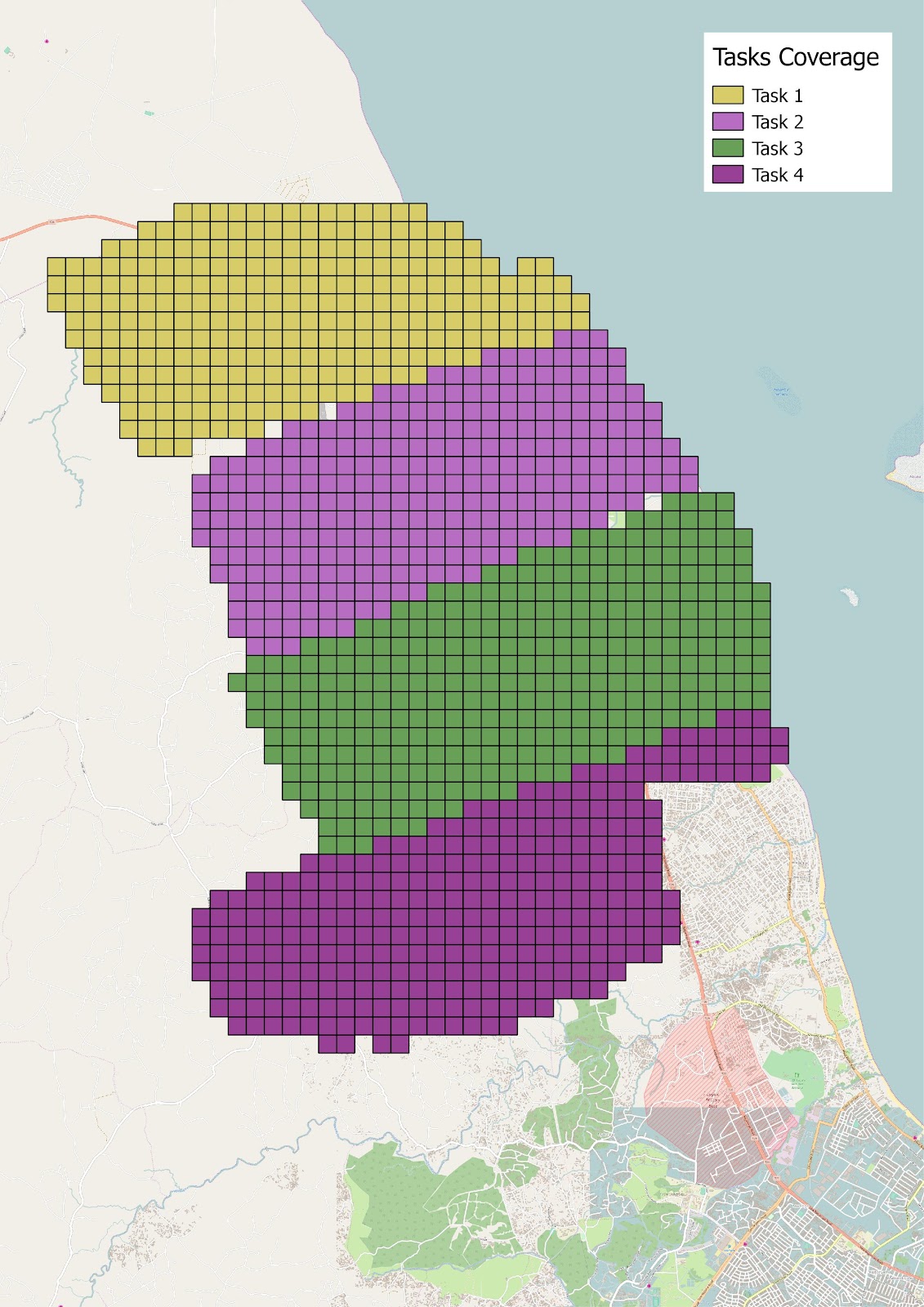
Map Image Of Areas Being Digitized (Task Perimeters)

Closeup Of Student Tracing A Building

By the end of the day on Monday, inspired by the amazing result of the student practice survey, we embark upon a critical experiment: can we leverage our three hundred students to create a thousand community-based mappers? We hand out some “scratch cards” containing mobile phone credit, and instruct the students to approach people in their own communities, give them some airtime credit, teach them to download and install ODK, and fill out a registration survey. On Tuesday morning the preliminary results are in; 170 community members have demonstrated an ability to fill out a basic survey with ODK on their own phones! The students, however, are not satisfied, saying that they can do much better if they have more time. Today we will end the JOSM session early and see how they do with this.

The Ramani Huria dream, and indeed the dream of open mapping projects everywhere, is to make the map a participatory process involving the entire community, belonging to everyone. If our students are able to train and empower citizens to collect, understand, and use local data in their own communities, who knows what we can accomplish?

Categories
Uncategorized

Three Hundred Students to Map for Flood Resilience in Dar es Salaam

The Humanitarian OpenStreetMap Team (HOT) and Ramani Huria, supported by the World Bank and partners are launching a brand-new adventure with Ardhi University today!

Three hundred Urban Planning and Geomatics students from Ardhi University in Dar es Salaam are participating in a community mapping project in July and August. We will be mapping in 35 wards of the city, with an emphasis on the data needed to improve flood resilience.

With the increasing impact of climate change and urbanization, urban flooding increasingly disrupts and threatens the lives of people in Dar es Salaam. To support people in the city, we are mapping drainage, health care services (important to reduce illness and mortality when flooding does happen, particularly for children), toilets, water sources, and building infrastructure.

We will also be working to better understand where flooding has happened in the past and where it may happen in the future based on the knowledge of people in the neighbourhoods, as well as measurements of elevation, drainage modelling, and so forth.

Training three hundred students in community mapping is a huge challenge and an opportunity! Just to organize such a large cohort is a complex logistical exercise. We must ensure that the students learn valuable skills, produce high-quality data, and work effectively with local neighbourhood communities. Fortunately we have a team including ten of the former students from previous Ramani Huria community mapping projects that have graduated and gone on to be leaders; they will be instrumental in guiding the new students through their learning and mapping process.

Students learning about Ramani Huria, and their role in the project at the UDSM CoICT campus/dLab

As always, the data gathered by Ramani Huria belongs to the people of Dar es Salaam. It is open data, accessible to everyone on the OpenStreetMap platform. Not only is it used for flood management planning, improvements to health care, drainage, and other infrastructure, but people can use this in free, offline maps on their smartphones that do not require Internet data and local businesses can use it to improve customer services. A high-quality map, freely available and filled with locally-useful data, helps almost everyone, and especially so if it belongs to the people themselves!

If you are in Dar es Salaam in the next few months, expect to see our intrepid teams throughout the city gather the essential data that makes the city a better, stronger, more resilient place. And keep an eye on the map!

Categories
Uncategorized

Ramani Huria volunteers support #HapaUsafiTu

Independence Day and Republic Day in Tanzania falls on the 9th of December, typically a day off work with many people gathering at the National Stadium to watch parades match in front of the President. Dances are performed and a torch is carried up Mount Kilimanjaro, symbolising liberty and self-determination of the nations in Africa. However, in 2015, for the first time, the day will be celebrated in a very different way.

Recently elected, President Magufuli declared that celebrations of Independence Day and Republic Day would be a chance for all citizens of the country to clean their local environment, from offices to schools, streets to homes. With support from all Government departments & agencies, many private organisations and non-governmental organisations also participated in the efforts – including Ramani Huria! The efforts were named #HapaUsafiTu (Here is just cleaning), reflecting the slogan of the recently elected president, ‘Hapa Kazi Tu’ (Here is just work). 

Ramani Huria and Red Cross volunteers taking part in #HapaUsafiTu PHOTO CREDIT: Ramani Huria

Ramani Huria volunteers participated in #HapaUsafiTu in several of the wards we have conducted mapping, including the wards of Ndugumbi, Tandale, Vingunguti, Manzese, Mzimini, Kigogo, Mwanayamala, Buguruni, Magomeni, Manzese.

Volunteers working hard to clean streets PHOTO CREDIT: Ramani Huria

As well as cleaning activities, including bus stands such as Chama in Buguruni, the volunteers engaged with residents of the wards on the importance of sanitation. Recently Dar es Salaam and several areas of Tanzania has seen outbreaks of Cholera so the cleaning efforts could not come at a more important time. With many wards of Dar es Salaam being highly populated and unplanned, much of the population is it a high risk for the outbreak of disease, especially in the rainy season. The volunteers discussed with community members how best to maintain the cleanliness of areas, specifically clearing rubbish and keeping waterways and drains free of blockages. 

Cleaning in Kigogo ward, one of the areas Ramani Huria has mapped PHOTO CREDIT: Ramani Huria

After a day of intensive cleaning, it was apparent that this day of work had had a big impact on the city of Dar es Salaam. Through the discussions we had with community members, many people felt that there should be similar days in the future and had plans to request from the local administration that there be additional cleaning activities. Ramani Huria and the volunteers from Red Cross and HOT were all pleased to be able to continue to support the wards we have been actively mapping. 

Categories
Uncategorized

Community Mapping has a Long-lasting Impact in Tandale

Ward Executive Officer for Tandale Mr Osiligi Lossai CREDIT: Ramani Huria

The ward of Tandale was one of the first wards in Dar es Salaam to benefit from community mapping and be comprehensively mapped on OpenStreetMap.  Ramani Huria recently spoke to Ward Executive Officer for Tandale Mr Osiligi Lossai about how they are using the data and maps provided to the ward following the completion of mapping.

Map of Tandale created through community mapping: download here CREDIT: Ramani Huria 

Dar es Salaam experienced a rare cholera outbreak in August 2015, and it is continuing to affect the city. Tandale has been one of the wards most affected by the outbreak. The outbreak has been unexpected as it is currently the dry season in Tanzania, with incidences of cholera usually occurring during the rainy seasons. Mr Lossai said that his office has been using the maps provided by Ramani Huria to identify the location of the victims within the ward. The maps have provided them with detail information on water points and sanitation data, thus allowing his team to investigate the sources of the outbreak.

Drainage map of Tandale created through community mapping: download here CREDIT: Ramani Huria 

Mr. Lossai is in the process of writing a project proposal to the Municipal Council which aims to improve the drainage system in his ward. While he acknowledges that people have settled in flood-prone areas, he says it is not easy or likely to resettle them. Because of this, the current situation must be improved, and this includes developing the drainage system. With the maps developed by Ramani Huria, which include current drainage infrastructure, Mr Lossai is better informed and able to identify key points to be developed or improved in future planning.

Following on from the mapping that took place in Tandale, Mr. Lossai has developed relationships with Urban Planning graduates who continue to help him and his colleagues in the future planning of the ward and improving the livelihoods of those who live there. Mr. Lossia concluded by saying that the maps created through community mapping have been invaluable and will continue to be of use to the ward of Tandale in years to come.

Read more about mapping in Tandale

Categories
Uncategorized

Community Mapping can greatly contribute to the development of Dar es Salaam

Mchikichini ward community member Mr. Monday Antony CREDIT: Ramani Huria
Mchikichini ward community member Mr Monday Antony CREDIT: Ramani Huria

Mr. Monday Antony is a 66-year-old Tanzanian, living in Mchikichini ward, Ilala District, Dar es Salaam. He participated in “Community Mapping for Flood Resilience”, and talked to Steven Bukulu (mapping supervisor for Ramani Huria) about the flooding in many areas of Dar es Salaam.

“The population has decreased in the low altitude areas since the last tragic incident of floods that happened in 2013, which got all houses submerged in water. Due to the loss and damage of property, many of these people shifted to safer areas to improve and build up their lives. In addition, many of their small scale businesses were no more.”, he says. “Many of those that are currently living here are new to this area. They have no clear clue or idea of what floods can do to them when heavy rains occur,” he adds. “What has greatly contributed to floods in Dar es Salaam is the way that houses have blocked passage for large volumes of water. This water collects from different areas on higher altitudes of the city to big waterways and channels like River Msimbazi that passes through this ward.”

Flooding in Dar es Salaam CREDIT: Ramani Huria

On top of that, residents of these areas have poor waste disposal behavior. “People don’t care where they are supposed dump their garbage which takes us back to poor urban planning. If only they knew how this has greatly contributed to drains being blocked 24/7 till now as we speak in a dry season, then they would understand what proper way they should do it. These drains help so much in reducing floods by draining large volumes of water from different areas to the main water channels and help reduce the floods. Without this happening, we can’t avoid floods”, he stresses.

Mr Monday Antony, who himself was not affected by the last floods that happened earlier this year in May 2015, says that people’s lack of response to bad weather forecasts has caused them damages that include loss of property and serious injury. “If only they would be attentive on what is said on the news, all this disaster wouldn’t happen.

Considering community involvement in mapping for flood resilience in Mchikichini Ward, Mr Antony confesses that the activities were really important to them and the outcome will be even better since the data would have been verified by the local community. He sees it as being an important program for local people to participate, even though the biggest challenge is that it is very hard for those who didn’t draw maps during their early stages of education to adapt to the current digital mapping skills with the use of computers, GPS units and Field Papers.

Drainage ditches in Dar es Salaam CREDIT: Ramani Huria

Mr Antony agrees with the view that digital mapping is essential for keeping current records for the future generation. In addition to that, digital maps can be shared and accessed at any one time on the internet through OpenStreetMap. He suggested that subward officers should be informed that this data is open source so even in their absence, the same information can be retrieved and used for administrative work. He also points out the essential nature of maps during National census, vaccination campaigns and urban planning. As well as when setting up polling stations ahead of elections, and improving social services like health centres, schools, roads, water supply, and electricity distribution. This will build stronger communities to promote equity and opportunities. 

Mapping in process in Dar es Salaam CREDIT: Ramani Huria

Mr Anthony ascertains that once the learning material is put into hard copies, it will be easier for the community to pass on the skills of digitizing different areas on OpenStreetMap to other people who are not yet exposed to this technology, including his generation. “It has now been translated in Swahili, that makes it much easier,” he says.

Mapping in process in Dar es Salaam CREDIT: Ramani Huria

Finally, he tells us: “Mapping begins with one’s interest. If all the people that are interested in mapping receive advanced training, they would be able to make a huge difference to the socio-economic development in Tanzania, and assist in training other people in their community once the project is done.”