Data for Waste Management: A Comparison between Formal and Informal Settlements in Dar es Salaam, Tanzania.
For the last 4 years, Ramani Huria – a project based in Dar es Salaam, Tanzania, led by Humanitarian OpenStreetMap Team (HOT) and supported by the World Bank – have mapped the drains, rivers, and other infrastructures across Dar es Salaam, to provide information for flood management. By mapping the city’s most flood-prone wards, we learnt that high urbanization and unplanned settlements have led to the mismanagement of waste materials, with negative knock-on effects.
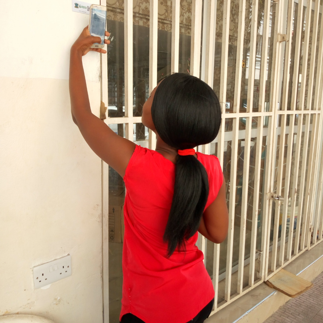
Dar es Salaam produces an estimated 5,600 tonnes of waste per day, of which about 60% remains uncollected. Much of the waste then ends up in stormwater drains, which pollutes the runoff water, rivers and coastal waters and exacerbates annual flooding events and the spread of diseases. To assess the extent of the problem, the Ramani Huria team conducted a pilot in two settlements in the city – one formal and one informal – to map clients’ locations and create a digital system of client tracking to support waste collection companies with their daily trash collection.
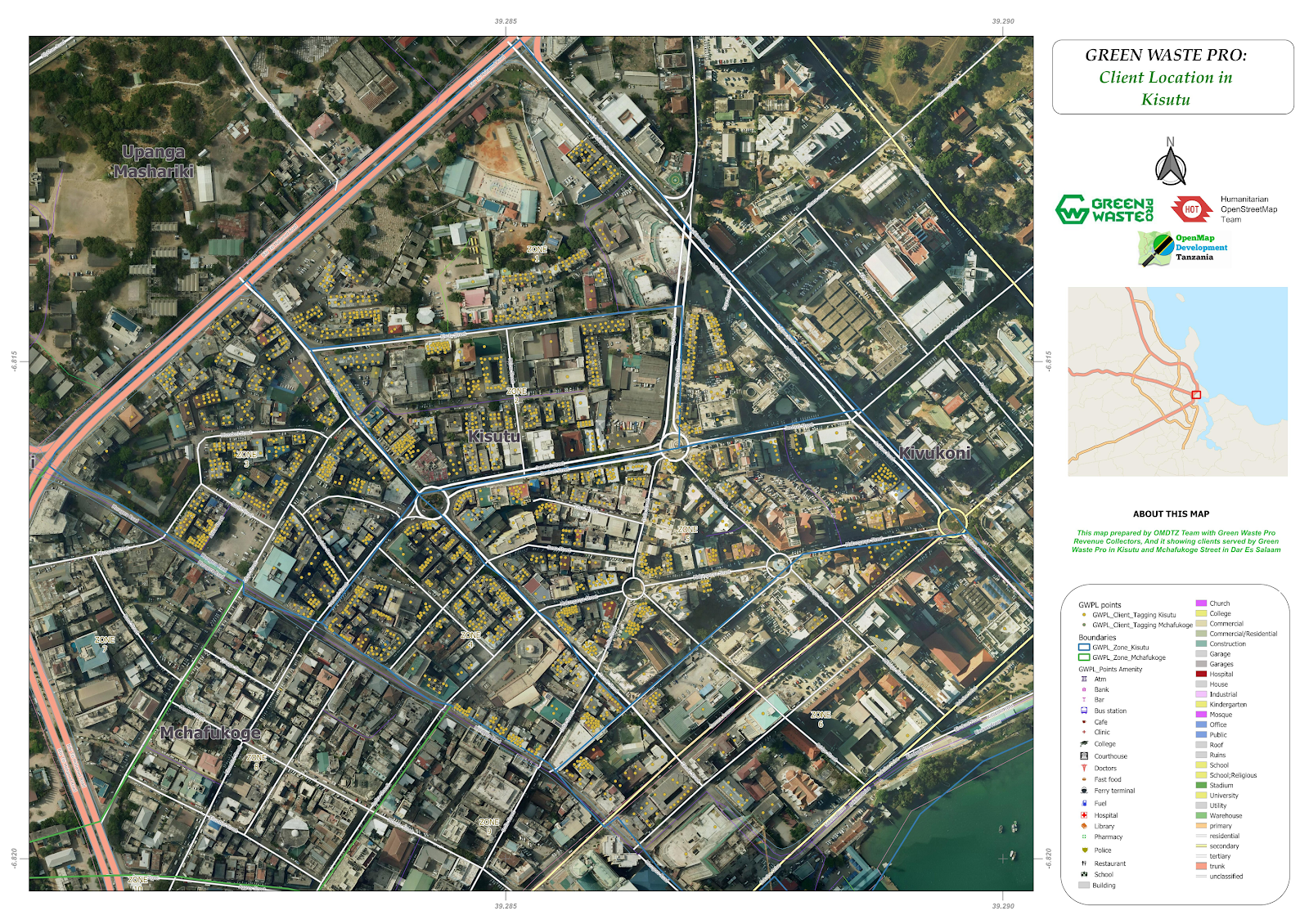
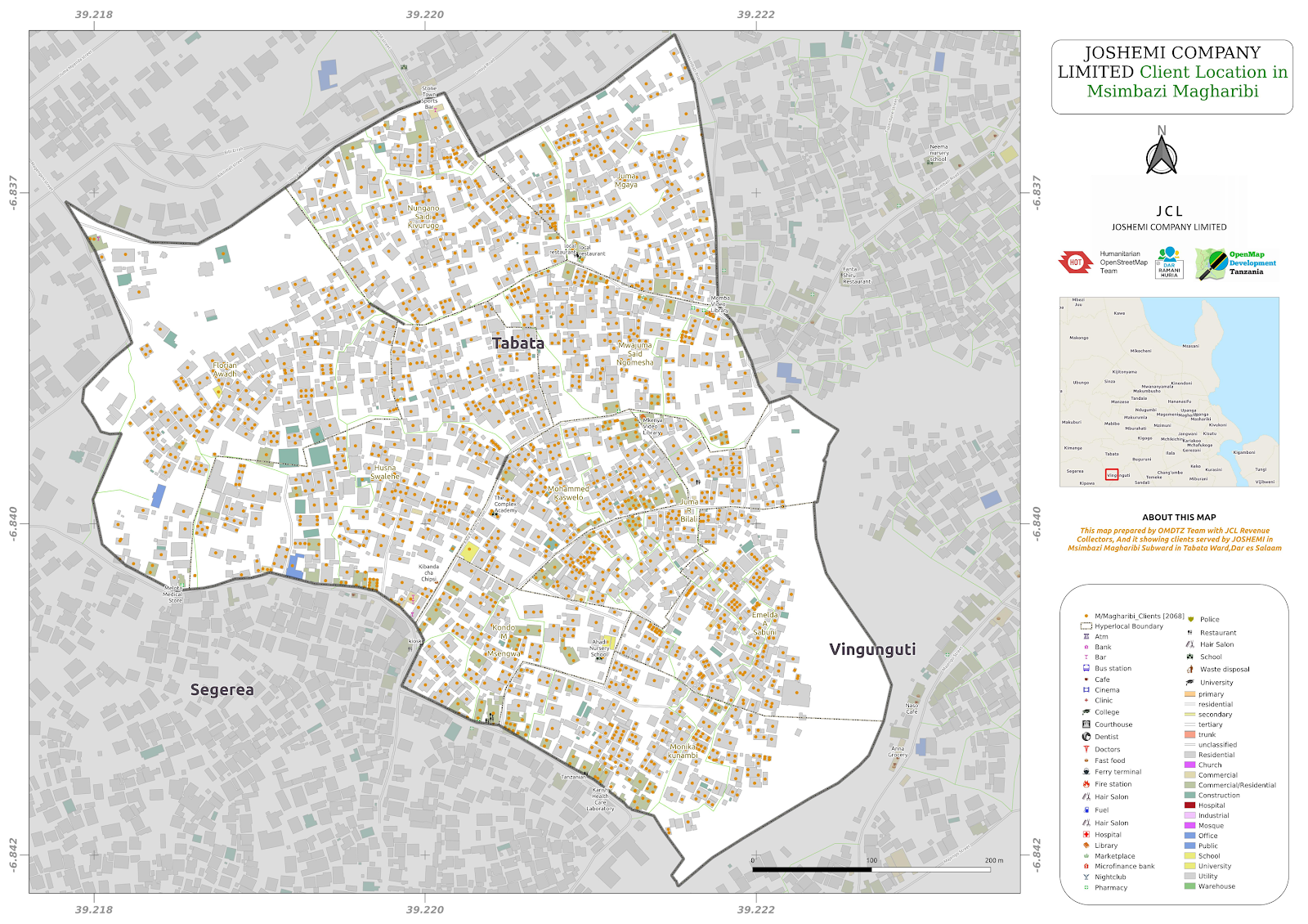
Ramani Huria partnered with two trash collection companies, Green WastePro Ltd. (operating in formal settlements in downtown) and Joshemi Company Ltd. (operating in informal settlements in Tabata Ward). By providing the companies with digital datasets they are now able to locate their clients and significantly improve the sanitary conditions of neighbourhoods as well as reducing the risk of flooding. We have reported earlier on the usability of this data on informal settings and published an article on how these datasets can tackle waste management in Dar es Salaam.
As 70% of the city is made up of informal settlements, HOT decided to develop data on unplanned areas. Informal settlements in developing countries typically face severe environmental and health consequences due to ineffective household waste management, but by collecting comprehensive data on the location of the clients, the companies will be able to easily track them and improve waste collection services, hence reducing poor waste disposal and make Dar es Salaam more flood resilient.
With the project coming to an end, we thought we would take the opportunity to reflect on what the data for waste management has shown us and teach us about other growing cities in developing countries. Here are the four main things we have learnt:
- Level of awareness
In formal areas, they have a higher level of exposure in the use of technology and technical abilities than informal areas. For example, in formal areas, clients have a unique barcode to identify them, whereas informal settings, our mappers had to assign unofficial ID numbers in order to support revenue collectors by making data collection easier because the ID numbers show the exact location of each client.
- Companies invest more in planned/formal areas than informal.
Previously, waste management companies mainly operated in formal areas. This may be because of perceived costs as customers in these areas are more likely to pay for the service. There are normally no individual waste collectors on formal areas compared to informal areas where there are many individual (informal) waste collectors, and this may be a reason for companies to invest more.
But as we discovered by collecting data, companies are missing out on revenue opportunities by not collecting in informal areas. In February 2018, HOT provided waste management companies with data that helped improve their collection services in two formal wards (Kisutu and Mchafukoge) which lead to a significant increase in the revenue of the company.
- Communities in informal settings are left behind when it comes to waste collection.
Communities in informal settings depend on individual waste collectors as most of the companies tend to collect trash from business owners that normally reside along roads. Inaccessibility, as most people don’t live on main roads and the smaller roads/tracks in the informal settlements, are hard to access, lack of information that clearly shows how many people need services and the location of potential customers that need companies’ services may be the reason for the low investment of companies on trash collection. By providing this information, it can help companies and authorities to make better decisions on waste collection, and in turn, making the city clean and reduce the risk of flooding caused by blockage of drainage systems.
There are also weak links to formal systems of waste management chains and neighbourhood responses to bridge these gaps, making them ineffective in localities where the needs for improved services are the most pressing. Data that HOT provided in Tabata Ward helped Joshemi Company Limited (JCL) locate and know the number of potential clients, although it is yet unclear if this has increased revenue.
- Waste management systems are rarely described and analyzed from the perspective of communities in informal settings.
A more sophisticated system was developed for formal waste collection companies compared to the system developed in the informal setting. After the mapping a capacity building and daily support on map use from HOT team to support the company’s ability to use data. However, waste management systems are rarely described and analyzed from the perspective of how informality interacts (or not) with formal waste management systems, but the difference is huge yet bringing the same/similar outcome.
3 replies on “What Waste Management Taught us about Data.”
[…] entire sector. This is because data that is fit-for-purpose finds its own audience, as in the case data broke the Nash equilibrium between trash collection companies and […]