

WaSH is a collective term for water, sanitation and hygiene. While each is a separate field of work, they are interdependent in nature.
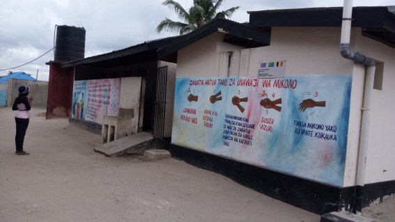
After flooding, communities are very vulnerable to outbreaks of disease such as cholera. Building off a foundation of ongoing response efforts for this in Dar es Salaam, Ramani Huria has started a rapid sanitation mapping campaign within the city’s wards, mainly focusing on public toilets.
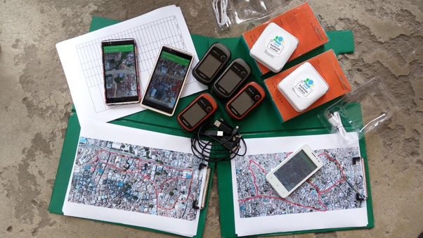
With the well-trained Ramani Huria team available, this is approached by dividing the team into two groups with two different methods of data collection but the same final output. This offers an opportunity to test which methods can best support the WaSH mapping. The methods used for data collection include:
The first method refers to a normal data collection method that involves producing fieldpapers for the site, grabbing a GPS unit and data collection forms, then heading to the site for data collection, while the second method involves installing phone apps that are equipped with data collection forms and imagery for data collection while in the field.

Pre-field work
These are activities that are conducted before visiting the site for data collection. The following steps have to be followed before the actual mapping begins:
- Preparation of the data model. The data model was developed from the OSM wiki page compiling the toilet tags that are applicable to Dar es Salaam’s situation.
- Checking availability of imagery. Imagery, specifically that which has been produced by drones, is helpful in producing field papers for the areas where mapping is to be completed.
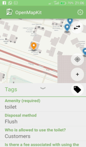
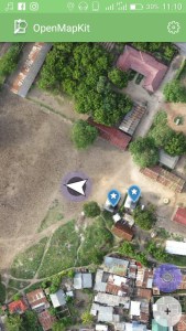
- For OpenMapKit, data collection surveys using ODK are to be prepared, reflecting the data model that was developed. The surveys include questions that will be filled by mappers while making site visits to collect data.
- For the group using GPS units, data collection forms are prepared and printed for mappers to fill while making site visits to collect data.
- Producing and printing fieldpapers. The fieldpapers will guide mappers during site visit, showing boundary for the working area.
- Last but not least, making official contacts with the ward’s local leaders is a critical activity to take place before mapping. This is done through official lettering.
Fieldwork
- The first task is to check that each and every tool is properly working before heading out into the field. Making sure all smartphones are fully charged and power banks are brought out. After this, the fieldpapers are divided amongst mappers using both OMK and GPS units.

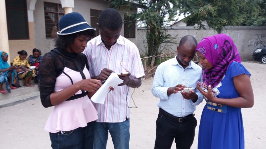
- Splitting off for data collection. Every mapper must go to the area from which he/she is supposed to collect data. For both groups, the information collected during the process includes toilet disposal, either by flush/pit latrine/bucket or chemical, accessibility of the toilet, number of chambers per each toilet, who is responsible for the operating toilet, etc. After data collection, mappers return to the working space – most often a ward office.



Post-field work
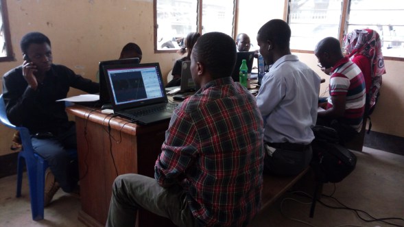
- The final step is to enter the data into the OSM platform where digitization using JOSM editor takes place. Both mappers using GPS units and OMK for data collection partake in this activity.

Comparison, working with OMK and GPS units
OMK is the best method for this task simply because it is the faster method of collecting data – offering mappers the ability to fill out ODK forms on a smartphone and showing mappers their location and imagery at the same time. The much more time-consuming method of using GPS/pen and paper requires that a mapper uses GPS to geolocate the area, a pre-produced fieldpaper to know the site, and a pen and paper for taking notes.
Additional pros
- Loading Imagery – OMK can load imagery, eg. drone’s mbtiles, and can be used during site visit while GPS cannot – necessitating the pre-production of fieldpapers to aid mappers during site visit.
- Accuracy – GPS accuracy may sometimes decrease due to cloud cover, leading to shifting the point of interest. This is not faced while working with OMK.
- Time-saving – OMK saves time when working with JOSM editor, as tags for the toilets are added while filling in the ODK forms during the site visit. As a result, it only requires importing the data onto the computer and JOSM and then uploading it, unlike when the GPS/pen and paper method that requires mappers to manually digitize, add tags, then upload data. The latter is often a tedious process if a significant amount of data was collected.
- Fun – It’s more fun working with OMK than GPS/paper method because it’s a smartphone app.
Cons:
Hasara
- OMK consumes internet data when using online OpenStreetMap instead of imagery as a basemap background, unlike GPS units that do not have a need for internet as they use satellites to geolocate.
- OMK inatumia kifurushi cha mtandao wakati wa kutumia OpenStreetMap kwa mtandao, badala ya picha kama picha ya nyuma, tofauti na vifaa vya GPS haiitaji kifurushi cha mtandao, ambapo inatumia sattelite kuonyesha maeneo.
- OMK consumes a phone’s battery while working, unlike GPS units. However, this problem has been addressed by using power banks to charge phones while working.
- OMK inatumia betri ya simu wakati wa kufanya kazi, tofauti na kifaa cha GPS, Hatahivyo tatizo hili limeshughulikiwa kwa kutumia kifaa cha kutunzia umeme kuichaji simu wakati ikitumika.